

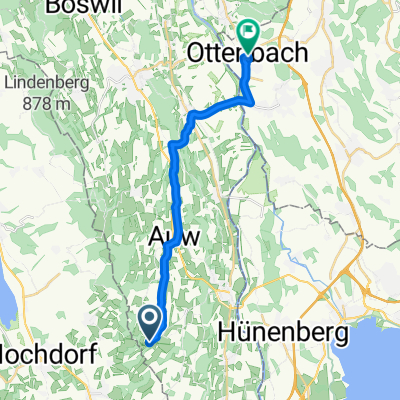
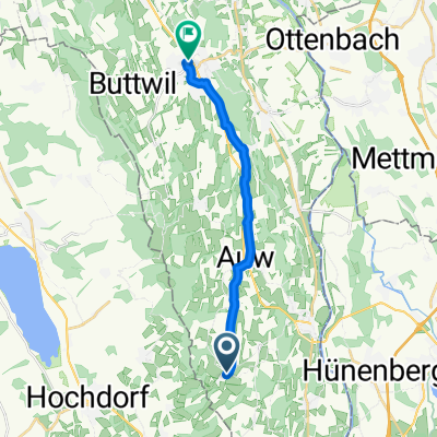
Abtwil - Ottenbach
A cycling route starting in Hohenrain, Canton of Lucerne, Switzerland.
Overview
About this route
- -:--
- Duration
- 16.2 km
- Distance
- 63 m
- Ascent
- 190 m
- Descent
- ---
- Avg. speed
- ---
- Max. altitude

Route quality
Waytypes & surfaces along the route
Waytypes
Road
9.7 km
(60 %)
Quiet road
2.4 km
(15 %)
Surfaces
Paved
5.8 km
(36 %)
Unpaved
0.2 km
(1 %)
Asphalt
3.9 km
(24 %)
Paved (undefined)
1.9 km
(12 %)
Continue with Bikemap
Use, edit, or download this cycling route
You would like to ride Abtwil - Ottenbach or customize it for your own trip? Here is what you can do with this Bikemap route:
Free features
- Save this route as favorite or in collections
- Copy & plan your own version of this route
- Sync your route with Garmin or Wahoo
Premium features
Free trial for 3 days, or one-time payment. More about Bikemap Premium.
- Navigate this route on iOS & Android
- Export a GPX / KML file of this route
- Create your custom printout (try it for free)
- Download this route for offline navigation
Discover more Premium features.
Get Bikemap PremiumFrom our community
Other popular routes starting in Hohenrain
 Michel
- Distance
- 34.6 km
- Ascent
- 552 m
- Descent
- 552 m
- Location
- Hohenrain, Canton of Lucerne, Switzerland
 Abtwil - Ottenbach
- Distance
- 16.2 km
- Ascent
- 63 m
- Descent
- 190 m
- Location
- Hohenrain, Canton of Lucerne, Switzerland
 Abtwil AG nach Rigiblickstrasse, Abtwil AG
- Distance
- 18.9 km
- Ascent
- 453 m
- Descent
- 490 m
- Location
- Hohenrain, Canton of Lucerne, Switzerland
 Arbeitsweg Debbie
- Distance
- 15.4 km
- Ascent
- 48 m
- Descent
- 225 m
- Location
- Hohenrain, Canton of Lucerne, Switzerland
 Abtwil AG nach Rüstenschwil 2, Auw
- Distance
- 23 km
- Ascent
- 386 m
- Descent
- 510 m
- Location
- Hohenrain, Canton of Lucerne, Switzerland
 Muri - Abtwil
- Distance
- 13 km
- Ascent
- 51 m
- Descent
- 118 m
- Location
- Hohenrain, Canton of Lucerne, Switzerland
 Rain Baldegg Ermensee Beinwil Seengen Meisterschwanden Aesch Hitzkirch Gelfingen Kleinwangenstrasse Balldeg Ligschwil Rain
- Distance
- 68.3 km
- Ascent
- 646 m
- Descent
- 842 m
- Location
- Hohenrain, Canton of Lucerne, Switzerland
 Tschuepisstrasse, Kleinwangen nach Löwengraben 33, Luzern
- Distance
- 20.4 km
- Ascent
- 146 m
- Descent
- 216 m
- Location
- Hohenrain, Canton of Lucerne, Switzerland
Open it in the app