

Restful route in Stanford-le-Hope
A cycling route starting in Purfleet-on-Thames, England, United Kingdom.
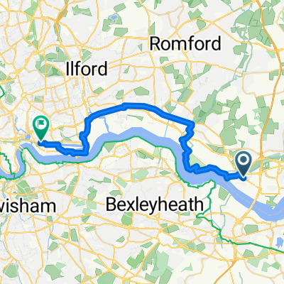
Overview
About this route
- 25 min
- Duration
- 8.1 km
- Distance
- 37 m
- Ascent
- 22 m
- Descent
- 19.6 km/h
- Avg. speed
- ---
- Max. altitude
Route quality
Waytypes & surfaces along the route
Waytypes
Cycleway
6.4 km
(79 %)
Quiet road
0.8 km
(10 %)
Surfaces
Paved
1.9 km
(23 %)
Asphalt
1.9 km
(23 %)
Undefined
6.2 km
(77 %)
Continue with Bikemap
Use, edit, or download this cycling route
You would like to ride Restful route in Stanford-le-Hope or customize it for your own trip? Here is what you can do with this Bikemap route:
Free features
- Save this route as favorite or in collections
- Copy & plan your own version of this route
- Sync your route with Garmin or Wahoo
Premium features
Free trial for 3 days, or one-time payment. More about Bikemap Premium.
- Navigate this route on iOS & Android
- Export a GPX / KML file of this route
- Create your custom printout (try it for free)
- Download this route for offline navigation
Discover more Premium features.
Get Bikemap PremiumFrom our community
Other popular routes starting in Purfleet-on-Thames
 R.S.P.B. Purfleet Environment & Education Centre to Lyell Street 7
- Distance
- 27.4 km
- Ascent
- 280 m
- Descent
- 272 m
- Location
- Purfleet-on-Thames, England, United Kingdom
 River Thames
- Distance
- 95.6 km
- Ascent
- 301 m
- Descent
- 288 m
- Location
- Purfleet-on-Thames, England, United Kingdom
 Romford to Purfleet: NCN Route 136 & 13
- Distance
- 12.3 km
- Ascent
- 0 m
- Descent
- 6 m
- Location
- Purfleet-on-Thames, England, United Kingdom
 Relaxed route in Purfleet
- Distance
- 21.8 km
- Ascent
- 7 m
- Descent
- 19 m
- Location
- Purfleet-on-Thames, England, United Kingdom
 From Purfleet 1
- Distance
- 27.1 km
- Ascent
- 19 m
- Descent
- 30 m
- Location
- Purfleet-on-Thames, England, United Kingdom
 Purfleet to West Thurrock Way
- Distance
- 33.2 km
- Ascent
- 66 m
- Descent
- 70 m
- Location
- Purfleet-on-Thames, England, United Kingdom
 Purfleet - Rainham Marsh
- Distance
- 14.8 km
- Ascent
- 46 m
- Descent
- 50 m
- Location
- Purfleet-on-Thames, England, United Kingdom
 Saladin Drive 32 to R.S.P.B. Purfleet Environment & Education Centre
- Distance
- 1.7 km
- Ascent
- 8 m
- Descent
- 15 m
- Location
- Purfleet-on-Thames, England, United Kingdom
Open it in the app