

Barcelona 13
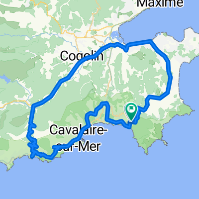
A cycling route starting in Ramatuelle, Provence-Alpes-Côte d'Azur Region, France.
Overview
About this route
- -:--
- Duration
- 74.1 km
- Distance
- 398 m
- Ascent
- 402 m
- Descent
- ---
- Avg. speed
- 75 m
- Max. altitude
Route quality
Waytypes & surfaces along the route
Waytypes
Busy road
47.9 km
(65 %)
Quiet road
11.1 km
(15 %)
Surfaces
Paved
63 km
(85 %)
Unpaved
0.7 km
(<1 %)
Asphalt
62.8 km
(85 %)
Unpaved (undefined)
0.6 km
(<1 %)
Continue with Bikemap
Use, edit, or download this cycling route
You would like to ride Barcelona 13 or customize it for your own trip? Here is what you can do with this Bikemap route:
Free features
- Save this route as favorite or in collections
- Copy & plan your own version of this route
- Sync your route with Garmin or Wahoo
Premium features
Free trial for 3 days, or one-time payment. More about Bikemap Premium.
- Navigate this route on iOS & Android
- Export a GPX / KML file of this route
- Create your custom printout (try it for free)
- Download this route for offline navigation
Discover more Premium features.
Get Bikemap PremiumFrom our community
Other popular routes starting in Ramatuelle
 Saint Tropez
- Distance
- 52.5 km
- Ascent
- 616 m
- Descent
- 616 m
- Location
- Ramatuelle, Provence-Alpes-Côte d'Azur Region, France
 679 Chemin de la Douane, Ramatuelle à 484 Route de Tahiti, Ramatuelle
- Distance
- 11.6 km
- Ascent
- 204 m
- Descent
- 221 m
- Location
- Ramatuelle, Provence-Alpes-Côte d'Azur Region, France
 Gigaro 60
- Distance
- 59.1 km
- Ascent
- 589 m
- Descent
- 583 m
- Location
- Ramatuelle, Provence-Alpes-Côte d'Azur Region, France
 Barcelona 13
- Distance
- 74.1 km
- Ascent
- 398 m
- Descent
- 402 m
- Location
- Ramatuelle, Provence-Alpes-Côte d'Azur Region, France
 Urlaubsrunde
- Distance
- 70.6 km
- Ascent
- 591 m
- Descent
- 600 m
- Location
- Ramatuelle, Provence-Alpes-Côte d'Azur Region, France
 Rundtour Ramatuelle
- Distance
- 47.6 km
- Ascent
- 789 m
- Descent
- 788 m
- Location
- Ramatuelle, Provence-Alpes-Côte d'Azur Region, France
 Friedel_geplante_Route_1
- Distance
- 112.7 km
- Ascent
- 1,201 m
- Descent
- 1,201 m
- Location
- Ramatuelle, Provence-Alpes-Côte d'Azur Region, France
 Côte d’Azur 2016 - Ramatuelle - Saint Tropez
- Distance
- 38.9 km
- Ascent
- 627 m
- Descent
- 627 m
- Location
- Ramatuelle, Provence-Alpes-Côte d'Azur Region, France
Open it in the app