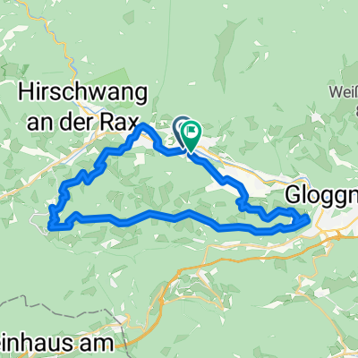
- 30.3 km
- 796 m
- 793 m
- Payerbach, Lower Austria, Austria
Niederoesterr-steirische Passrunde
A cycling route starting in Payerbach, Lower Austria, Austria.
Overview
About this route
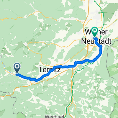
Arrival: by train to Payerbach - of course, you can also start from Gloggniz. From here via Preiner Gscheid, Niederalpl, the Styrian Seeberg, the Pretalsattel and finally over the Semmering to Gloggniz.
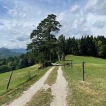
Nice loop over 5 'passes' in NOE and Stmk. Still largely free of pollution and destruction from 'bike paths' - unfortunately, in the upper Mürztal there is already a legally unclear obstacle in the form of an accompanying path that constantly changes sides and should be avoided as much as possible.
Variation options for climbing and descending at Semmering; here ascent via the old pass road and descent for speed fun on the federal road.
- -:--
- Duration
- 144.2 km
- Distance
- 1,983 m
- Ascent
- 2,038 m
- Descent
- ---
- Avg. speed
- ---
- Max. altitude
Route quality
Waytypes & surfaces along the route
Waytypes
Quiet road
11.5 km
(8 %)
Cycleway
8.6 km
(6 %)
Surfaces
Paved
103.8 km
(72 %)
Asphalt
103.8 km
(72 %)
Undefined
40.4 km
(28 %)
Continue with Bikemap
Use, edit, or download this cycling route
You would like to ride Niederoesterr-steirische Passrunde or customize it for your own trip? Here is what you can do with this Bikemap route:
Free features
- Save this route as favorite or in collections
- Copy & plan your own version of this route
- Split it into stages to create a multi-day tour
- Sync your route with Garmin or Wahoo
Premium features
Free trial for 3 days, or one-time payment. More about Bikemap Premium.
- Navigate this route on iOS & Android
- Export a GPX / KML file of this route
- Create your custom printout (try it for free)
- Download this route for offline navigation
Discover more Premium features.
Get Bikemap PremiumFrom our community
Other popular routes starting in Payerbach
- Kreuzbergstrecke
- Kreuzbergstrecke Gloggnitz
- 28.5 km
- 1,099 m
- 1,091 m
- Payerbach, Lower Austria, Austria
- Payerbach-Baden ueber Hubertussee
- 169.5 km
- 1,616 m
- 1,877 m
- Payerbach, Lower Austria, Austria
- Rec Kreuzbergstrecke + Heimweg
- 56.2 km
- 1,184 m
- 1,211 m
- Payerbach, Lower Austria, Austria
- Payerbach-Leopoldsdorf
- 189.9 km
- 1,102 m
- 1,440 m
- Payerbach, Lower Austria, Austria
- Kreuzbergstecke vom Bahnhof Payerbach-Reichenau (Ohne Singletrails)
- 32.4 km
- 1,143 m
- 1,143 m
- Payerbach, Lower Austria, Austria
- Payerbach Bhf bis Wr Neustadt Bhf
- 48.1 km
- 46 m
- 265 m
- Payerbach, Lower Austria, Austria
- Reichenau, Rohr, Furtner, Gutenstein
- 51.4 km
- 1,674 m
- 1,678 m
- Payerbach, Lower Austria, Austria
Open it in the app


