
Main-Alpen - 2. Teil (Weißenhasel - Welkers)
A cycling route starting in Nentershausen, Hesse, Germany.
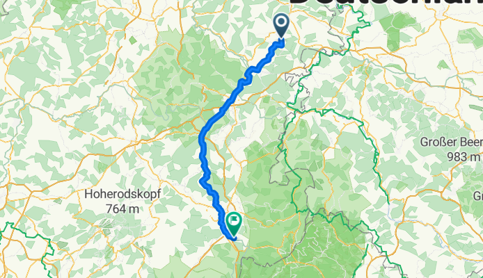
Overview
About this route
- -:--
- Duration
- 94 km
- Distance
- 301 m
- Ascent
- 263 m
- Descent
- ---
- Avg. speed
- ---
- Max. altitude
Route quality
Waytypes & surfaces along the route
Waytypes
Track
42.4 km
(45 %)
Quiet road
16.1 km
(17 %)
Surfaces
Paved
86.7 km
(92 %)
Unpaved
1.6 km
(2 %)
Asphalt
75.3 km
(80 %)
Paving stones
6.8 km
(7 %)
Route highlights
Points of interest along the route
Accommodation after 90.7 km
Landgasthof Kramer
Continue with Bikemap
Use, edit, or download this cycling route
You would like to ride Main-Alpen - 2. Teil (Weißenhasel - Welkers) or customize it for your own trip? Here is what you can do with this Bikemap route:
Free features
- Save this route as favorite or in collections
- Copy & plan your own version of this route
- Split it into stages to create a multi-day tour
- Sync your route with Garmin or Wahoo
Premium features
Free trial for 3 days, or one-time payment. More about Bikemap Premium.
- Navigate this route on iOS & Android
- Export a GPX / KML file of this route
- Create your custom printout (try it for free)
- Download this route for offline navigation
Discover more Premium features.
Get Bikemap PremiumFrom our community
Other popular routes starting in Nentershausen
 Nentershausen nach Nentershausen über Breitau, Krauthausen, Wichmannshausen
- Distance
- 28.6 km
- Ascent
- 391 m
- Descent
- 393 m
- Location
- Nentershausen, Hesse, Germany
 nach Hoheneiche über Breitau (B 400 entlang)
- Distance
- 36.5 km
- Ascent
- 308 m
- Descent
- 309 m
- Location
- Nentershausen, Hesse, Germany
 Home-Run
- Distance
- 9.9 km
- Ascent
- 32 m
- Descent
- 183 m
- Location
- Nentershausen, Hesse, Germany
 Main-Alpen - 2. Teil (Weißenhasel - Welkers)
- Distance
- 94 km
- Ascent
- 301 m
- Descent
- 263 m
- Location
- Nentershausen, Hesse, Germany
 St 002: Weissenhasel - Eichenzell
- Distance
- 106.8 km
- Ascent
- 327 m
- Descent
- 308 m
- Location
- Nentershausen, Hesse, Germany
 P18 Tannenburg 8 km
- Distance
- 8.4 km
- Ascent
- 258 m
- Descent
- 260 m
- Location
- Nentershausen, Hesse, Germany
 Nentershausen nach Bebra, über Rautenhausen zurück
- Distance
- 34.3 km
- Ascent
- 483 m
- Descent
- 486 m
- Location
- Nentershausen, Hesse, Germany
 Von der Hohen Buche in den Ringgau
- Distance
- 71.7 km
- Ascent
- 1,172 m
- Descent
- 1,172 m
- Location
- Nentershausen, Hesse, Germany
Open it in the app