

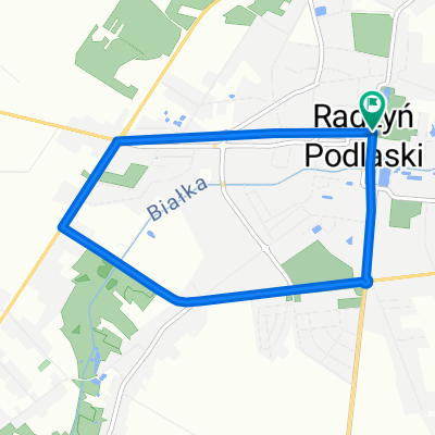
RadzynPod MiedzyrzecPod
A cycling route starting in Radzyń Podlaski, Lublin Voivodeship, Poland.
Overview
About this route
- -:--
- Duration
- 86.7 km
- Distance
- 58 m
- Ascent
- 57 m
- Descent
- ---
- Avg. speed
- ---
- Max. altitude

Route quality
Waytypes & surfaces along the route
Waytypes
Road
47.7 km
(55 %)
Quiet road
21.7 km
(25 %)
Surfaces
Paved
63.3 km
(73 %)
Unpaved
3.5 km
(4 %)
Asphalt
59.8 km
(69 %)
Paved (undefined)
3.5 km
(4 %)
Continue with Bikemap
Use, edit, or download this cycling route
You would like to ride RadzynPod MiedzyrzecPod or customize it for your own trip? Here is what you can do with this Bikemap route:
Free features
- Save this route as favorite or in collections
- Copy & plan your own version of this route
- Split it into stages to create a multi-day tour
- Sync your route with Garmin or Wahoo
Premium features
Free trial for 3 days, or one-time payment. More about Bikemap Premium.
- Navigate this route on iOS & Android
- Export a GPX / KML file of this route
- Create your custom printout (try it for free)
- Download this route for offline navigation
Discover more Premium features.
Get Bikemap PremiumFrom our community
Other popular routes starting in Radzyń Podlaski
 trasa 1
- Distance
- 76.5 km
- Ascent
- 56 m
- Descent
- 56 m
- Location
- Radzyń Podlaski, Lublin Voivodeship, Poland
 RadzynPod MiedzyrzecPod
- Distance
- 86.7 km
- Ascent
- 58 m
- Descent
- 57 m
- Location
- Radzyń Podlaski, Lublin Voivodeship, Poland
 Radzyń Podlaski - trasa miejska
- Distance
- 5.9 km
- Ascent
- 18 m
- Descent
- 18 m
- Location
- Radzyń Podlaski, Lublin Voivodeship, Poland
 Rowerowy Radzyń -rozpoczęcie sezonu 2012.
- Distance
- 65.5 km
- Ascent
- 72 m
- Descent
- 74 m
- Location
- Radzyń Podlaski, Lublin Voivodeship, Poland
 Zminne
- Distance
- 74.9 km
- Ascent
- 134 m
- Descent
- 138 m
- Location
- Radzyń Podlaski, Lublin Voivodeship, Poland
 RadzynPod Kock
- Distance
- 58.5 km
- Ascent
- 134 m
- Descent
- 136 m
- Location
- Radzyń Podlaski, Lublin Voivodeship, Poland
 Radzyn 1
- Distance
- 49.1 km
- Ascent
- 175 m
- Descent
- 173 m
- Location
- Radzyń Podlaski, Lublin Voivodeship, Poland
 Koncepcja szlaku Doliną Tyśmienicy
- Distance
- 48.4 km
- Ascent
- 92 m
- Descent
- 93 m
- Location
- Radzyń Podlaski, Lublin Voivodeship, Poland
Open it in the app