

Grimmelbach - Wasentegernbach - Wörth
A cycling route starting in Schwindegg, Bavaria, Germany.
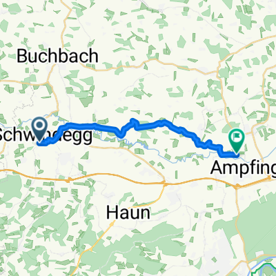
Overview
About this route
relatively flat - except for the long hill between Schwindkirchen and Wasentegernbach,
relatively long hill between Wasentegernbach and Hub
- -:--
- Duration
- 17.7 km
- Distance
- 152 m
- Ascent
- 152 m
- Descent
- ---
- Avg. speed
- ---
- Max. altitude
Route quality
Waytypes & surfaces along the route
Waytypes
Quiet road
9.2 km
(52 %)
Road
5.6 km
(32 %)
Surfaces
Paved
11.5 km
(65 %)
Unpaved
0.4 km
(2 %)
Asphalt
11.5 km
(65 %)
Gravel
0.4 km
(2 %)
Undefined
5.8 km
(33 %)
Continue with Bikemap
Use, edit, or download this cycling route
You would like to ride Grimmelbach - Wasentegernbach - Wörth or customize it for your own trip? Here is what you can do with this Bikemap route:
Free features
- Save this route as favorite or in collections
- Copy & plan your own version of this route
- Sync your route with Garmin or Wahoo
Premium features
Free trial for 3 days, or one-time payment. More about Bikemap Premium.
- Navigate this route on iOS & Android
- Export a GPX / KML file of this route
- Create your custom printout (try it for free)
- Download this route for offline navigation
Discover more Premium features.
Get Bikemap PremiumFrom our community
Other popular routes starting in Schwindegg
 Autumn Schwindegg
- Distance
- 68.2 km
- Ascent
- 429 m
- Descent
- 366 m
- Location
- Schwindegg, Bavaria, Germany
 RBC-OTK-SWG-STG-GTGB-WTGB-SWK
- Distance
- 24.4 km
- Ascent
- 218 m
- Descent
- 218 m
- Location
- Schwindegg, Bavaria, Germany
 Schwindegg - Poing II
- Distance
- 47.8 km
- Ascent
- 255 m
- Descent
- 175 m
- Location
- Schwindegg, Bavaria, Germany
 Route zu Grüne Lagune
- Distance
- 15.2 km
- Ascent
- 112 m
- Descent
- 135 m
- Location
- Schwindegg, Bavaria, Germany
 Goldachtal-Vilstal-Isental
- Distance
- 40.3 km
- Ascent
- 171 m
- Descent
- 171 m
- Location
- Schwindegg, Bavaria, Germany
 Schwindegg-Mettenhein-Ranoldsberg-Schwindegg
- Distance
- 45 km
- Ascent
- 244 m
- Descent
- 256 m
- Location
- Schwindegg, Bavaria, Germany
 Schwindegg – Poing
- Distance
- 46.9 km
- Ascent
- 247 m
- Descent
- 166 m
- Location
- Schwindegg, Bavaria, Germany
 Ranoldsberg -Velden - Taufkirchen - Schwindegg
- Distance
- 51.2 km
- Ascent
- 298 m
- Descent
- 298 m
- Location
- Schwindegg, Bavaria, Germany
Open it in the app