

SALIDA ALPUJARREÑA
A cycling route starting in Órgiva, Andalusia, Spain.
Overview
About this route
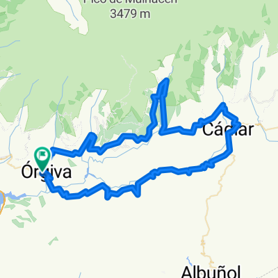
Departure from the BP in Orgiva. Direction Trevélez passing Pampaneira where we make the refreshment stop. Direction Cadiar passing by Juviles. From Cadiar we take the A-348, passing through Torvizcón, to return to Órgiva.
- -:--
- Duration
- 98.8 km
- Distance
- 1,589 m
- Ascent
- 1,588 m
- Descent
- ---
- Avg. speed
- ---
- Max. altitude

Route quality
Waytypes & surfaces along the route
Waytypes
Road
56.3 km
(57 %)
Quiet road
3 km
(3 %)
Surfaces
Paved
93.8 km
(95 %)
Asphalt
92.8 km
(94 %)
Concrete
1 km
(1 %)
Undefined
4.9 km
(5 %)
Continue with Bikemap
Use, edit, or download this cycling route
You would like to ride SALIDA ALPUJARREÑA or customize it for your own trip? Here is what you can do with this Bikemap route:
Free features
- Save this route as favorite or in collections
- Copy & plan your own version of this route
- Split it into stages to create a multi-day tour
- Sync your route with Garmin or Wahoo
Premium features
Free trial for 3 days, or one-time payment. More about Bikemap Premium.
- Navigate this route on iOS & Android
- Export a GPX / KML file of this route
- Create your custom printout (try it for free)
- Download this route for offline navigation
Discover more Premium features.
Get Bikemap PremiumFrom our community
Other popular routes starting in Órgiva
 SALIDA ALPUJARREÑA
- Distance
- 98.8 km
- Ascent
- 1,589 m
- Descent
- 1,588 m
- Location
- Órgiva, Andalusia, Spain
 Clásica de las Alpujarras
- Distance
- 187.2 km
- Ascent
- 3,592 m
- Descent
- 3,023 m
- Location
- Órgiva, Andalusia, Spain
 orgiva -lanjaron
- Distance
- 32.5 km
- Ascent
- 1,607 m
- Descent
- 1,419 m
- Location
- Órgiva, Andalusia, Spain
 Las Alpujarras y la Contraviesa.
- Distance
- 107.6 km
- Ascent
- 3,284 m
- Descent
- 3,285 m
- Location
- Órgiva, Andalusia, Spain
 S6: Picena von West
- Distance
- 138.3 km
- Ascent
- 4,156 m
- Descent
- 4,137 m
- Location
- Órgiva, Andalusia, Spain
 Orgiva - Lanjaron - Durcal - Guajar Faragüit
- Distance
- 91.8 km
- Ascent
- 1,515 m
- Descent
- 1,512 m
- Location
- Órgiva, Andalusia, Spain
 Orgiva - Mulhacen - Orgiva
- Distance
- 93.1 km
- Ascent
- 2,977 m
- Descent
- 2,977 m
- Location
- Órgiva, Andalusia, Spain
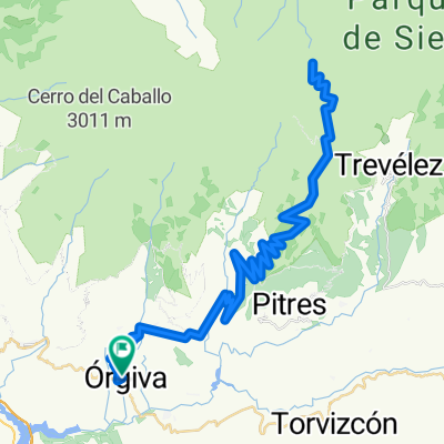
 Orgiva-Trevelez-Orgiva
- Distance
- 75.7 km
- Ascent
- 1,471 m
- Descent
- 1,471 m
- Location
- Órgiva, Andalusia, Spain
Open it in the app