

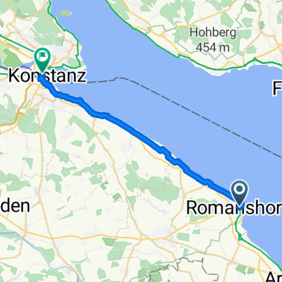
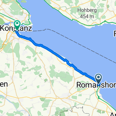
Route - Tag 2 (Teil 2)
A cycling route starting in Romanshorn, Thurgau, Switzerland.
Overview
About this route
- 2 h 3 min
- Duration
- 18 km
- Distance
- 16 m
- Ascent
- 12 m
- Descent
- 8.8 km/h
- Avg. speed
- ---
- Max. altitude

Route quality
Waytypes & surfaces along the route
Waytypes
Cycleway
9.4 km
(52 %)
Quiet road
4.7 km
(26 %)
Surfaces
Paved
16.6 km
(92 %)
Unpaved
1.4 km
(8 %)
Asphalt
16.6 km
(92 %)
Gravel
0.7 km
(4 %)
Loose gravel
0.7 km
(4 %)
Continue with Bikemap
Use, edit, or download this cycling route
You would like to ride Route - Tag 2 (Teil 2) or customize it for your own trip? Here is what you can do with this Bikemap route:
Free features
- Save this route as favorite or in collections
- Copy & plan your own version of this route
- Sync your route with Garmin or Wahoo
Premium features
Free trial for 3 days, or one-time payment. More about Bikemap Premium.
- Navigate this route on iOS & Android
- Export a GPX / KML file of this route
- Create your custom printout (try it for free)
- Download this route for offline navigation
Discover more Premium features.
Get Bikemap PremiumFrom our community
Other popular routes starting in Romanshorn
 Bahnhofstrasse 7, Romanshorn nach 17 83, Schmerikon
- Distance
- 71.8 km
- Ascent
- 1,077 m
- Descent
- 1,077 m
- Location
- Romanshorn, Thurgau, Switzerland
 Schwägalp, St.Anton
- Distance
- 129.2 km
- Ascent
- 2,390 m
- Descent
- 2,386 m
- Location
- Romanshorn, Thurgau, Switzerland
 Rundkurs Moulen, Sulgen
- Distance
- 46.7 km
- Ascent
- 313 m
- Descent
- 295 m
- Location
- Romanshorn, Thurgau, Switzerland
 From Romanshorn to Constance
- Distance
- 22 km
- Ascent
- 69 m
- Descent
- 70 m
- Location
- Romanshorn, Thurgau, Switzerland
 Romanshorn-Konstanz
- Distance
- 109.1 km
- Ascent
- 256 m
- Descent
- 257 m
- Location
- Romanshorn, Thurgau, Switzerland
 Von Romanshorn bis Konstanz
- Distance
- 20.8 km
- Ascent
- 57 m
- Descent
- 63 m
- Location
- Romanshorn, Thurgau, Switzerland
 Im Bahnhof, Romanshorn nach Stelzenhofstrasse, Weinfelden
- Distance
- 28.5 km
- Ascent
- 460 m
- Descent
- 210 m
- Location
- Romanshorn, Thurgau, Switzerland
 Sitterweg
- Distance
- 39.1 km
- Ascent
- 326 m
- Descent
- 326 m
- Location
- Romanshorn, Thurgau, Switzerland
Open it in the app