

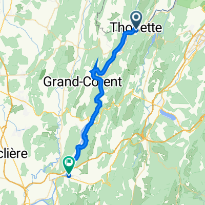
Etappe 13 (Zutphen-Avignon)
A cycling route starting in Izernore, Auvergne-Rhône-Alpes, France.
Overview
About this route
13e deel van fietsvakantie van Zutphen naar Avignon in 2005
- -:--
- Duration
- 72.7 km
- Distance
- 785 m
- Ascent
- 832 m
- Descent
- ---
- Avg. speed
- ---
- Max. altitude
Route quality
Waytypes & surfaces along the route
Waytypes
Road
5.8 km
(8 %)
Quiet road
4.4 km
(6 %)
Surfaces
Paved
13.1 km
(18 %)
Unpaved
0.7 km
(1 %)
Asphalt
13.1 km
(18 %)
Gravel
0.7 km
(1 %)
Undefined
58.9 km
(81 %)
Continue with Bikemap
Use, edit, or download this cycling route
You would like to ride Etappe 13 (Zutphen-Avignon) or customize it for your own trip? Here is what you can do with this Bikemap route:
Free features
- Save this route as favorite or in collections
- Copy & plan your own version of this route
- Sync your route with Garmin or Wahoo
Premium features
Free trial for 3 days, or one-time payment. More about Bikemap Premium.
- Navigate this route on iOS & Android
- Export a GPX / KML file of this route
- Create your custom printout (try it for free)
- Download this route for offline navigation
Discover more Premium features.
Get Bikemap PremiumFrom our community
Other popular routes starting in Izernore
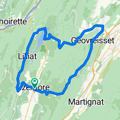
 Signal du Cuiron
- Distance
- 33.2 km
- Ascent
- 604 m
- Descent
- 589 m
- Location
- Izernore, Auvergne-Rhône-Alpes, France
 Yzernore, Matafelon, Cerdon - Haut Bugey
- Distance
- 45.5 km
- Ascent
- 704 m
- Descent
- 824 m
- Location
- Izernore, Auvergne-Rhône-Alpes, France
 Grande Rue 49, Thoirette-Coisia to Place Feltin 2, Poncin
- Distance
- 29.3 km
- Ascent
- 424 m
- Descent
- 453 m
- Location
- Izernore, Auvergne-Rhône-Alpes, France
 Granges 54 km
- Distance
- 55 km
- Ascent
- 671 m
- Descent
- 671 m
- Location
- Izernore, Auvergne-Rhône-Alpes, France
 Etappe 13 (Zutphen-Avignon)
- Distance
- 72.7 km
- Ascent
- 785 m
- Descent
- 832 m
- Location
- Izernore, Auvergne-Rhône-Alpes, France
 Matafelon-Tour
- Distance
- 33.6 km
- Ascent
- 434 m
- Descent
- 425 m
- Location
- Izernore, Auvergne-Rhône-Alpes, France
 Thoirette East
- Distance
- 55.4 km
- Ascent
- 967 m
- Descent
- 968 m
- Location
- Izernore, Auvergne-Rhône-Alpes, France
 Yzernore - Samognat - Matafelon, boucle
- Distance
- 26.3 km
- Ascent
- 500 m
- Descent
- 500 m
- Location
- Izernore, Auvergne-Rhône-Alpes, France
Open it in the app