

Johann'stadt Karlovy Vary Tour 2
A cycling route starting in Johanngeorgenstadt, Saxony, Germany.
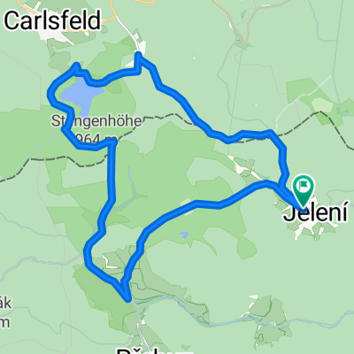
Overview
About this route
Wir kommen vom Johanngeorgenstädter Bahnhof, halten an der Informationstafel, fahren dann durch Potucky (Breitenbach) rechts haltend weiter in Richtung Horni Blatna (Bergstadt Platten). An der neugotischen Kirche (1872) und der ehemaligen "Dreckschänke" vorbei kommen wir über "Ochsendorf" nach Horni Blatna.
Eine mit Schindeln gedeckte Kirche (16. Jahrhundert) und gute Gästehäuser am Markt erwarten uns. An der Auffahrt zum Blatensky v. (Plattenberg) 1043 m vorbei radeln wir auf der Str. (Nr. 2198) weiter nach Pernik (Bärringen).
Mit Blick auf den Plesivec (Plessberg) 1028 m radeln wir auf der Straße (Nr. 2003) weiter, halten uns dann aber talabwärts über Pstruzi (Salmtal) auf der Straße nach Merklin (Merkelsgrün). Entlang der Bystrice (Wystritz) und wieder auf der 2198 geht es nach Hroznetin (Lichtenstadt). Wir biegen vor der St. Peter - Paulskirche (1734) rechts ab, evtl. noch einen kurzen Besuch am nahe gelegenen See (Velky r.) und fahren über Velky Rybnik (Großer Teich) nach Podlesi (Widitzhof) einer alten Schäferei nach Otovice (Ottowitz). Von Otovice aus geht es auf kurzem Weg über Sedlec (Zettlitz) nach Karlovy Vary.
- -:--
- Duration
- 34.1 km
- Distance
- 354 m
- Ascent
- 629 m
- Descent
- ---
- Avg. speed
- ---
- Max. altitude
Route quality
Waytypes & surfaces along the route
Waytypes
Busy road
18.9 km
(55 %)
Road
12.2 km
(36 %)
Surfaces
Paved
16 km
(47 %)
Unpaved
0.7 km
(2 %)
Asphalt
16 km
(47 %)
Gravel
0.7 km
(2 %)
Undefined
17.3 km
(51 %)
Continue with Bikemap
Use, edit, or download this cycling route
You would like to ride Johann'stadt Karlovy Vary Tour 2 or customize it for your own trip? Here is what you can do with this Bikemap route:
Free features
- Save this route as favorite or in collections
- Copy & plan your own version of this route
- Sync your route with Garmin or Wahoo
Premium features
Free trial for 3 days, or one-time payment. More about Bikemap Premium.
- Navigate this route on iOS & Android
- Export a GPX / KML file of this route
- Create your custom printout (try it for free)
- Download this route for offline navigation
Discover more Premium features.
Get Bikemap PremiumFrom our community
Other popular routes starting in Johanngeorgenstadt
 Weitersglashuette-Jeleni-Rolava und zurück
- Distance
- 20.9 km
- Ascent
- 244 m
- Descent
- 244 m
- Location
- Johanngeorgenstadt, Saxony, Germany
 Breitenbach-Keilberg (CZ)
- Distance
- 42.4 km
- Ascent
- 694 m
- Descent
- 662 m
- Location
- Johanngeorgenstadt, Saxony, Germany
 kleine Grenzlandrunde
- Distance
- 89.7 km
- Ascent
- 1,331 m
- Descent
- 1,326 m
- Location
- Johanngeorgenstadt, Saxony, Germany
 Mulde-Elbe 2020 405km
- Distance
- 433.9 km
- Ascent
- 545 m
- Descent
- 1,120 m
- Location
- Johanngeorgenstadt, Saxony, Germany
 04 Jeleni - Jerabi vrch - Prebuz
- Distance
- 21.5 km
- Ascent
- 266 m
- Descent
- 264 m
- Location
- Johanngeorgenstadt, Saxony, Germany
 Erzkamm-Egertal-Erzkamm
- Distance
- 98.4 km
- Ascent
- 1,725 m
- Descent
- 1,652 m
- Location
- Johanngeorgenstadt, Saxony, Germany
 KAMM- BIKE-CROSS Kidsrace AK U11 und U13
- Distance
- 3.8 km
- Ascent
- 80 m
- Descent
- 68 m
- Location
- Johanngeorgenstadt, Saxony, Germany
 Schwarzenberg und über Kamm zurück
- Distance
- 62.6 km
- Ascent
- 1,013 m
- Descent
- 933 m
- Location
- Johanngeorgenstadt, Saxony, Germany
Open it in the app