

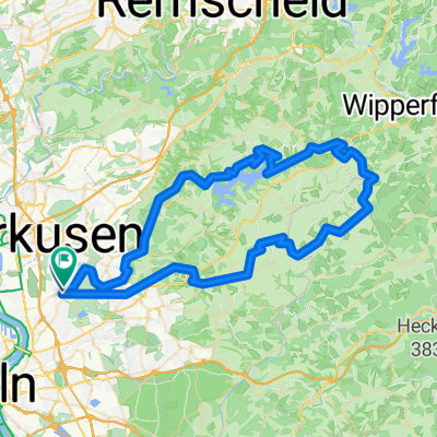
RTF Köln (Ford) 2007 2Pkt
A cycling route starting in Mülheim, North Rhine-Westphalia, Germany.
Overview
About this route
RTF event Ford Cologne, 2007, 71km, 2 BDR points
- -:--
- Duration
- 74.9 km
- Distance
- 726 m
- Ascent
- 703 m
- Descent
- ---
- Avg. speed
- 358 m
- Max. altitude
Route quality
Waytypes & surfaces along the route
Waytypes
Path
9.7 km
(13 %)
Road
6 km
(8 %)
Surfaces
Paved
62.9 km
(84 %)
Unpaved
0.7 km
(1 %)
Asphalt
62.9 km
(84 %)
Gravel
0.7 km
(1 %)
Undefined
11.2 km
(15 %)
Continue with Bikemap
Use, edit, or download this cycling route
You would like to ride RTF Köln (Ford) 2007 2Pkt or customize it for your own trip? Here is what you can do with this Bikemap route:
Free features
- Save this route as favorite or in collections
- Copy & plan your own version of this route
- Sync your route with Garmin or Wahoo
Premium features
Free trial for 3 days, or one-time payment. More about Bikemap Premium.
- Navigate this route on iOS & Android
- Export a GPX / KML file of this route
- Create your custom printout (try it for free)
- Download this route for offline navigation
Discover more Premium features.
Get Bikemap PremiumFrom our community
Other popular routes starting in Mülheim
 2 Tages-Tour ins Oberbergische.
- Distance
- 125.1 km
- Ascent
- 1,149 m
- Descent
- 1,143 m
- Location
- Mülheim, North Rhine-Westphalia, Germany
 Auf ins Bergische.
- Distance
- 78.6 km
- Ascent
- 691 m
- Descent
- 696 m
- Location
- Mülheim, North Rhine-Westphalia, Germany
 Rund um Bergisch Gladbach
- Distance
- 44 km
- Ascent
- 410 m
- Descent
- 407 m
- Location
- Mülheim, North Rhine-Westphalia, Germany
 MTB Strecke
- Distance
- 48.6 km
- Ascent
- 355 m
- Descent
- 358 m
- Location
- Mülheim, North Rhine-Westphalia, Germany
 warmrollen im bergischen land
- Distance
- 141.9 km
- Ascent
- 1,037 m
- Descent
- 1,037 m
- Location
- Mülheim, North Rhine-Westphalia, Germany
 Dünnthalsperren-Tour
- Distance
- 52.3 km
- Ascent
- 524 m
- Descent
- 510 m
- Location
- Mülheim, North Rhine-Westphalia, Germany
 Feldkreuz bei Lindlar und halbe Dhünntalumrundung
- Distance
- 79.5 km
- Ascent
- 669 m
- Descent
- 667 m
- Location
- Mülheim, North Rhine-Westphalia, Germany
 E-Bike Kochshof
- Distance
- 41 km
- Ascent
- 375 m
- Descent
- 375 m
- Location
- Mülheim, North Rhine-Westphalia, Germany
Open it in the app