

Entspannende Route in Berlin mit Pette
A cycling route starting in Köpenick, State of Berlin, Germany.
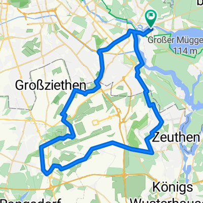
Overview
About this route
- 5 h 50 min
- Duration
- 47.6 km
- Distance
- 91 m
- Ascent
- 99 m
- Descent
- 8.2 km/h
- Avg. speed
- ---
- Max. altitude

Continue with Bikemap
Use, edit, or download this cycling route
You would like to ride Entspannende Route in Berlin mit Pette or customize it for your own trip? Here is what you can do with this Bikemap route:
Free features
- Save this route as favorite or in collections
- Copy & plan your own version of this route
- Sync your route with Garmin or Wahoo
Premium features
Free trial for 3 days, or one-time payment. More about Bikemap Premium.
- Navigate this route on iOS & Android
- Export a GPX / KML file of this route
- Create your custom printout (try it for free)
- Download this route for offline navigation
Discover more Premium features.
Get Bikemap PremiumFrom our community
Other popular routes starting in Köpenick
 Peterchens Rundfahrt
- Distance
- 33.2 km
- Ascent
- 48 m
- Descent
- 49 m
- Location
- Köpenick, State of Berlin, Germany
 Gosen-Hangelsberg-Kienbaum-Erkner
- Distance
- 64.2 km
- Ascent
- 118 m
- Descent
- 120 m
- Location
- Köpenick, State of Berlin, Germany
 Köpenick - Rahnsdorf - Gosen - Schmöckwitz - Köpenick
- Distance
- 34.1 km
- Ascent
- 88 m
- Descent
- 92 m
- Location
- Köpenick, State of Berlin, Germany
 Hauptmann von Köpenick
- Distance
- 127.6 km
- Ascent
- 338 m
- Descent
- 335 m
- Location
- Köpenick, State of Berlin, Germany
 gemütliche Tour am Langen See, Große Krampe, Müggelheim, Müggelsee CLONED FROM ROUTE 180167
- Distance
- 23.1 km
- Ascent
- 66 m
- Descent
- 66 m
- Location
- Köpenick, State of Berlin, Germany
 Köppenick-Erkner-Wernsdorf-Grünau-Köpenick
- Distance
- 36.5 km
- Ascent
- 78 m
- Descent
- 80 m
- Location
- Köpenick, State of Berlin, Germany
 Köpenick - Schulzendorf - Wassmannsdorf - Köpenick
- Distance
- 53.2 km
- Ascent
- 70 m
- Descent
- 74 m
- Location
- Köpenick, State of Berlin, Germany
 Müggelseerundtour
- Distance
- 28.4 km
- Ascent
- 59 m
- Descent
- 57 m
- Location
- Köpenick, State of Berlin, Germany
Open it in the app