

SentieriMTB-TraCorsiAcquaBrianza
A cycling route starting in Cernusco Lombardone, Lombardy, Italy.
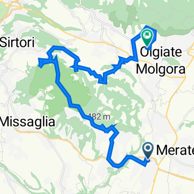
Overview
About this route
- -:--
- Duration
- 38 km
- Distance
- 392 m
- Ascent
- 459 m
- Descent
- ---
- Avg. speed
- ---
- Max. altitude

Route quality
Waytypes & surfaces along the route
Waytypes
Quiet road
11.4 km
(30 %)
Track
7.2 km
(19 %)
Surfaces
Paved
12.2 km
(32 %)
Unpaved
15.2 km
(40 %)
Asphalt
12.2 km
(32 %)
Ground
12.2 km
(32 %)
Continue with Bikemap
Use, edit, or download this cycling route
You would like to ride SentieriMTB-TraCorsiAcquaBrianza or customize it for your own trip? Here is what you can do with this Bikemap route:
Free features
- Save this route as favorite or in collections
- Copy & plan your own version of this route
- Sync your route with Garmin or Wahoo
Premium features
Free trial for 3 days, or one-time payment. More about Bikemap Premium.
- Navigate this route on iOS & Android
- Export a GPX / KML file of this route
- Create your custom printout (try it for free)
- Download this route for offline navigation
Discover more Premium features.
Get Bikemap PremiumFrom our community
Other popular routes starting in Cernusco Lombardone
 Via Alessandro Volta 3, Cernusco Lombardone a Via Mondonico 8, Olgiate Molgora
- Distance
- 20 km
- Ascent
- 615 m
- Descent
- 538 m
- Location
- Cernusco Lombardone, Lombardy, Italy
 WanderingBrianzaN-4
- Distance
- 35.1 km
- Ascent
- 369 m
- Descent
- 430 m
- Location
- Cernusco Lombardone, Lombardy, Italy
 IntornoAllaCollinaDiMontevecchia
- Distance
- 29.8 km
- Ascent
- 703 m
- Descent
- 699 m
- Location
- Cernusco Lombardone, Lombardy, Italy
 3Parchi-AddaNord-RioVallone-ColliBriantei
- Distance
- 73.9 km
- Ascent
- 731 m
- Descent
- 793 m
- Location
- Cernusco Lombardone, Lombardy, Italy
 20100605-brianzabergamasca
- Distance
- 65 km
- Ascent
- 433 m
- Descent
- 429 m
- Location
- Cernusco Lombardone, Lombardy, Italy
 ZEPPELIN2010_Ciclabile dell'Adda
- Distance
- 57.8 km
- Ascent
- 242 m
- Descent
- 359 m
- Location
- Cernusco Lombardone, Lombardy, Italy
 BrianzaRingN-1
- Distance
- 35.2 km
- Ascent
- 485 m
- Descent
- 478 m
- Location
- Cernusco Lombardone, Lombardy, Italy
 SterrateStradineParcoMontevecchia
- Distance
- 24.8 km
- Ascent
- 627 m
- Descent
- 625 m
- Location
- Cernusco Lombardone, Lombardy, Italy
Open it in the app