Brighton-Le-sands/route in Kyeemagh 28/9/19
A cycling route starting in Brighton-Le-Sands, New South Wales, Australia.
Overview
About this route
- 1 h 34 min
- Duration
- 18.4 km
- Distance
- 40 m
- Ascent
- 40 m
- Descent
- 11.8 km/h
- Avg. speed
- ---
- Avg. speed
Route quality
Waytypes & surfaces along the route
Waytypes
Cycleway
13.9 km
(75 %)
Pedestrian area
2.4 km
(13 %)
Surfaces
Paved
17.1 km
(93 %)
Unpaved
0.2 km
(1 %)
Paving stones
7.1 km
(39 %)
Concrete
4.9 km
(26 %)
Continue with Bikemap
Use, edit, or download this cycling route
You would like to ride Brighton-Le-sands/route in Kyeemagh 28/9/19 or customize it for your own trip? Here is what you can do with this Bikemap route:
Free features
- Save this route as favorite or in collections
- Copy & plan your own version of this route
- Sync your route with Garmin or Wahoo
Premium features
Free trial for 3 days, or one-time payment. More about Bikemap Premium.
- Navigate this route on iOS & Android
- Export a GPX / KML file of this route
- Create your custom printout (try it for free)
- Download this route for offline navigation
Discover more Premium features.
Get Bikemap PremiumFrom our community
Other popular routes starting in Brighton-Le-Sands
- Cook Park Trail, Brighton-Le-Sands to Spark Lane, Wolli Creek
- Distance
- 7.6 km
- Ascent
- 3 m
- Descent
- 6 m
- Location
- Brighton-Le-Sands, New South Wales, Australia
- The Grand Parade, Brighton-Le-Sands to 13-17 Coast Avenue, Cronulla
- Distance
- 16.6 km
- Ascent
- 0 m
- Descent
- 6 m
- Location
- Brighton-Le-Sands, New South Wales, Australia
- Brighton-Le-sands/route in Kyeemagh 28/9/19
- Distance
- 18.4 km
- Ascent
- 40 m
- Descent
- 40 m
- Location
- Brighton-Le-Sands, New South Wales, Australia
- Cook Park Trail, Brighton-Le-Sands to 9 Poole Street, Kingsgrove
- Distance
- 7.9 km
- Ascent
- 0 m
- Descent
- 3 m
- Location
- Brighton-Le-Sands, New South Wales, Australia
- Morning Rides - Flats
- Distance
- 13.4 km
- Ascent
- 42 m
- Descent
- 42 m
- Location
- Brighton-Le-Sands, New South Wales, Australia
- 2 Roslyn Avenue, Brighton-Le-Sands to 1A Roslyn Avenue, Brighton-Le-Sands
- Distance
- 12.2 km
- Ascent
- 3 m
- Descent
- 10 m
- Location
- Brighton-Le-Sands, New South Wales, Australia
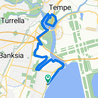
- 1A Roslyn Avenue, Brighton-Le-Sands to 1A Roslyn Avenue, Brighton-Le-Sands
- Distance
- 13.3 km
- Ascent
- 9 m
- Descent
- 17 m
- Location
- Brighton-Le-Sands, New South Wales, Australia
- (Map 2) The Laneways of Kogarah
- Distance
- 2.2 km
- Ascent
- 7 m
- Descent
- 8 m
- Location
- Brighton-Le-Sands, New South Wales, Australia
Open it in the app