

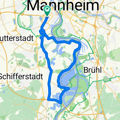
Quer durch die Vorderpfalz 2016 - RTF des RTC Pfeil Ludwigshafen - 112 km Strecke
A cycling route starting in Ludwigshafen am Rhein, Rhineland-Palatinate, Germany.
Overview
About this route
Quer durch die Vorderpfalz 2016 - 112 km
RTF des RTC Pfeil Ludwigshafen
Alle weiteren Hinweise zu dieser Strecke -> hier anklicken
- -:--
- Duration
- 112.7 km
- Distance
- 518 m
- Ascent
- 515 m
- Descent
- ---
- Avg. speed
- ---
- Max. altitude

Route quality
Waytypes & surfaces along the route
Waytypes
Busy road
59 km
(52 %)
Road
29 km
(26 %)
Surfaces
Paved
106.6 km
(95 %)
Unpaved
0.9 km
(<1 %)
Asphalt
101 km
(90 %)
Paving stones
2.3 km
(2 %)
Route highlights
Points of interest along the route
Point of interest after 19.1 km
Kontrolle 1 Dirmstein
Point of interest after 50 km
Kontrolle 2 Göllheim Häuschen
Point of interest after 79.7 km
Kontrolle 3 Freinsheim
Continue with Bikemap
Use, edit, or download this cycling route
You would like to ride Quer durch die Vorderpfalz 2016 - RTF des RTC Pfeil Ludwigshafen - 112 km Strecke or customize it for your own trip? Here is what you can do with this Bikemap route:
Free features
- Save this route as favorite or in collections
- Copy & plan your own version of this route
- Split it into stages to create a multi-day tour
- Sync your route with Garmin or Wahoo
Premium features
Free trial for 3 days, or one-time payment. More about Bikemap Premium.
- Navigate this route on iOS & Android
- Export a GPX / KML file of this route
- Create your custom printout (try it for free)
- Download this route for offline navigation
Discover more Premium features.
Get Bikemap PremiumFrom our community
Other popular routes starting in Ludwigshafen am Rhein
 MA - Speyer
- Distance
- 55.5 km
- Ascent
- 71 m
- Descent
- 71 m
- Location
- Ludwigshafen am Rhein, Rhineland-Palatinate, Germany
 Von Mannheim nach Eberbach
- Distance
- 56.5 km
- Ascent
- 211 m
- Descent
- 175 m
- Location
- Ludwigshafen am Rhein, Rhineland-Palatinate, Germany
 43_Ludwigshafen – Friedelsheim – Bad Dürkheim
- Distance
- 24.7 km
- Ascent
- 62 m
- Descent
- 18 m
- Location
- Ludwigshafen am Rhein, Rhineland-Palatinate, Germany
 BASF Radtour 2011
- Distance
- 159.1 km
- Ascent
- 667 m
- Descent
- 668 m
- Location
- Ludwigshafen am Rhein, Rhineland-Palatinate, Germany
 CYCLING THE RHINE: Route 16A
- Distance
- 79 km
- Ascent
- 119 m
- Descent
- 112 m
- Location
- Ludwigshafen am Rhein, Rhineland-Palatinate, Germany
 50 ziger Runde
- Distance
- 50.3 km
- Ascent
- 57 m
- Descent
- 57 m
- Location
- Ludwigshafen am Rhein, Rhineland-Palatinate, Germany
 Ludwigshafener Trainingsrunde
- Distance
- 41.2 km
- Ascent
- 63 m
- Descent
- 64 m
- Location
- Ludwigshafen am Rhein, Rhineland-Palatinate, Germany
 LU-Kalmit-LU
- Distance
- 97.5 km
- Ascent
- 688 m
- Descent
- 694 m
- Location
- Ludwigshafen am Rhein, Rhineland-Palatinate, Germany
Open it in the app