

DBM Cat03 - Templo Zu Lai - Morumbi
A cycling route starting in Taboão da Serra, São Paulo, Brazil.
Overview
About this route
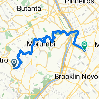
Route that goes to the Zulai Temple in Cotia, passing through Embu das Artes, ending at the Itapevi train station.
- -:--
- Duration
- 40.3 km
- Distance
- 701 m
- Ascent
- 691 m
- Descent
- ---
- Avg. speed
- 884 m
- Max. altitude

Route highlights
Points of interest along the route
Point of interest after 5.4 km
Trecho de uns 500 metros na contramão, para evitar ter que pedalar num perigoso trecho de BR
Point of interest after 9.8 km
Acessar a Rodovia, trecho com acostamento
Point of interest after 17.8 km
Parada em Embu das Artes para o café
Point of interest after 30.4 km
Templo Zulai
Point of interest after 40.3 km
Estação Itapevi da CPTM
Continue with Bikemap
Use, edit, or download this cycling route
You would like to ride DBM Cat03 - Templo Zu Lai - Morumbi or customize it for your own trip? Here is what you can do with this Bikemap route:
Free features
- Save this route as favorite or in collections
- Copy & plan your own version of this route
- Sync your route with Garmin or Wahoo
Premium features
Free trial for 3 days, or one-time payment. More about Bikemap Premium.
- Navigate this route on iOS & Android
- Export a GPX / KML file of this route
- Create your custom printout (try it for free)
- Download this route for offline navigation
Discover more Premium features.
Get Bikemap PremiumFrom our community
Other popular routes starting in Taboão da Serra
 Shopping Morumbi - Paulista x Pamplona
- Distance
- 10.9 km
- Ascent
- 182 m
- Descent
- 81 m
- Location
- Taboão da Serra, São Paulo, Brazil
 Portal-Do-Morumbi-Vila-Olimpia-sem-passar-pela-Giovanni-Gronchi
- Distance
- 13.8 km
- Ascent
- 184 m
- Descent
- 230 m
- Location
- Taboão da Serra, São Paulo, Brazil
 SP-PETAR-RS
- Distance
- 1,665.4 km
- Ascent
- 1,259 m
- Descent
- 2,063 m
- Location
- Taboão da Serra, São Paulo, Brazil
 Rota de quinta rápida com subidas
- Distance
- 44.8 km
- Ascent
- 256 m
- Descent
- 257 m
- Location
- Taboão da Serra, São Paulo, Brazil
 Portal-Do-Morumbi-Vila-Olimpia-quase-sem-subidas
- Distance
- 13.5 km
- Ascent
- 98 m
- Descent
- 145 m
- Location
- Taboão da Serra, São Paulo, Brazil
 Pico do Jaragua
- Distance
- 26.2 km
- Ascent
- 495 m
- Descent
- 201 m
- Location
- Taboão da Serra, São Paulo, Brazil
 Rota Ibirapuera Taboão Bikers
- Distance
- 34.5 km
- Ascent
- 131 m
- Descent
- 133 m
- Location
- Taboão da Serra, São Paulo, Brazil
 De Rua João de Sousa Carvalho 7441 a Unnamed Road
- Distance
- 12.3 km
- Ascent
- 129 m
- Descent
- 218 m
- Location
- Taboão da Serra, São Paulo, Brazil
Open it in the app