
WWSteig-Wiedweg
A cycling route starting in Linden, Rhineland-Palatinate, Germany.
Overview
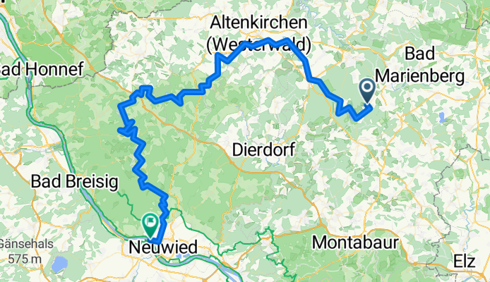
About this route
Challenging tour for well-trained mountain bikers with over approximately 1500 m of elevation. Scenically, this tour offers everything, streams and river valleys, heights with great views, trails, forest paths, well-developed country roads, and partially asphalted sections. A challenge for a strenuous day tour ending at the Rhine. Start at the Wied spring near Linden in the WW. An overnight stay at the Rhine is recommended, then the next day return partially via the Limesweg, Höhr Grenzhausen, Vielbach, Selters, WW Seenplatte. (Return route is still being developed).
- -:--
- Duration
- 104.4 km
- Distance
- 800 m
- Ascent
- 1,204 m
- Descent
- ---
- Avg. speed
- ---
- Max. altitude

Continue with Bikemap
Use, edit, or download this cycling route
You would like to ride WWSteig-Wiedweg or customize it for your own trip? Here is what you can do with this Bikemap route:
Free features
- Save this route as favorite or in collections
- Copy & plan your own version of this route
- Split it into stages to create a multi-day tour
- Sync your route with Garmin or Wahoo
Premium features
Free trial for 3 days, or one-time payment. More about Bikemap Premium.
- Navigate this route on iOS & Android
- Export a GPX / KML file of this route
- Create your custom printout (try it for free)
- Download this route for offline navigation
Discover more Premium features.
Get Bikemap PremiumFrom our community
Other popular routes starting in Linden
 WWSteig-Wiedweg
- Distance
- 104.4 km
- Ascent
- 800 m
- Descent
- 1,204 m
- Location
- Linden, Rhineland-Palatinate, Germany
 Wied, von der Quelle bis (fast) zur Mündung CLONED FROM ROUTE 193146
- Distance
- 89.4 km
- Ascent
- 283 m
- Descent
- 671 m
- Location
- Linden, Rhineland-Palatinate, Germany
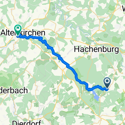
 Unnamed Road, Dreifelden nach Walter-Bernstein-Straße 36B, Hachenburg
- Distance
- 19 km
- Ascent
- 249 m
- Descent
- 281 m
- Location
- Linden, Rhineland-Palatinate, Germany
 Wied, von der Quelle bis (fast) zur Mündung
- Distance
- 89.3 km
- Ascent
- 823 m
- Descent
- 1,175 m
- Location
- Linden, Rhineland-Palatinate, Germany
 Stockum-Püschen - Almersbach
- Distance
- 23.7 km
- Ascent
- 208 m
- Descent
- 457 m
- Location
- Linden, Rhineland-Palatinate, Germany
 Route nach Hinter der Stollmigswiese 16, Hachenburg
- Distance
- 13.4 km
- Ascent
- 176 m
- Descent
- 235 m
- Location
- Linden, Rhineland-Palatinate, Germany
 20140419_171119.gpx
- Distance
- 11.5 km
- Ascent
- 185 m
- Descent
- 123 m
- Location
- Linden, Rhineland-Palatinate, Germany
Open it in the app