

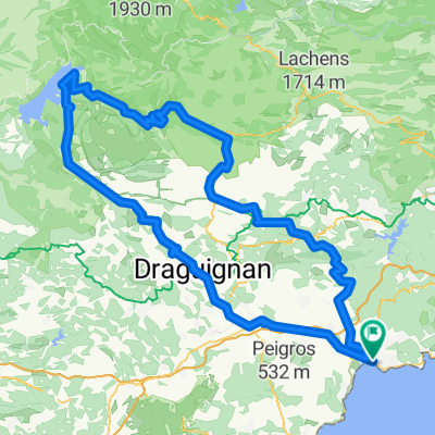
Tour du Mont Vinaigre
A cycling route starting in Saint-Raphaël, Provence-Alpes-Côte d'Azur Region, France.
Overview
About this route
- -:--
- Duration
- 17.4 km
- Distance
- 436 m
- Ascent
- 78 m
- Descent
- ---
- Avg. speed
- ---
- Max. altitude
Continue with Bikemap
Use, edit, or download this cycling route
You would like to ride Tour du Mont Vinaigre or customize it for your own trip? Here is what you can do with this Bikemap route:
Free features
- Save this route as favorite or in collections
- Copy & plan your own version of this route
- Sync your route with Garmin or Wahoo
Premium features
Free trial for 3 days, or one-time payment. More about Bikemap Premium.
- Navigate this route on iOS & Android
- Export a GPX / KML file of this route
- Create your custom printout (try it for free)
- Download this route for offline navigation
Discover more Premium features.
Get Bikemap PremiumFrom our community
Other popular routes starting in Saint-Raphaël
 les caous
- Distance
- 16.1 km
- Ascent
- 479 m
- Descent
- 491 m
- Location
- Saint-Raphaël, Provence-Alpes-Côte d'Azur Region, France
 Von Boulouris über Tanneron über die Corniche zurück
- Distance
- 84.8 km
- Ascent
- 2,479 m
- Descent
- 2,466 m
- Location
- Saint-Raphaël, Provence-Alpes-Côte d'Azur Region, France
 Esterelleküste und -berge
- Distance
- 64 km
- Ascent
- 584 m
- Descent
- 590 m
- Location
- Saint-Raphaël, Provence-Alpes-Côte d'Azur Region, France
 Tour du Mont Vinaigre
- Distance
- 17.4 km
- Ascent
- 436 m
- Descent
- 78 m
- Location
- Saint-Raphaël, Provence-Alpes-Côte d'Azur Region, France
 St. Raphael - Lac. St. Chroix
- Distance
- 194.3 km
- Ascent
- 2,128 m
- Descent
- 2,132 m
- Location
- Saint-Raphaël, Provence-Alpes-Côte d'Azur Region, France
 L'Esterel loop
- Distance
- 72 km
- Ascent
- 1,861 m
- Descent
- 1,824 m
- Location
- Saint-Raphaël, Provence-Alpes-Côte d'Azur Region, France
 esterel4
- Distance
- 28.5 km
- Ascent
- 429 m
- Descent
- 429 m
- Location
- Saint-Raphaël, Provence-Alpes-Côte d'Azur Region, France
 Esterel2
- Distance
- 35.8 km
- Ascent
- 550 m
- Descent
- 550 m
- Location
- Saint-Raphaël, Provence-Alpes-Côte d'Azur Region, France
Open it in the app