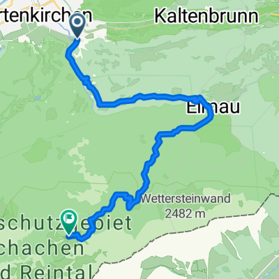
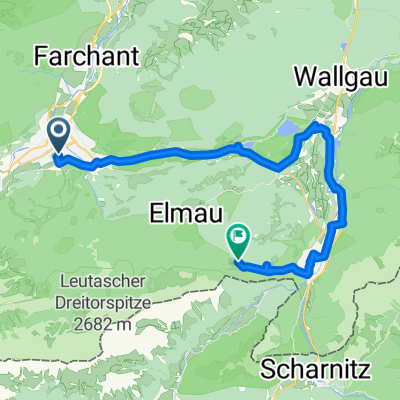
z-W07GAP-Skistadion-Kaiserschmarrn Alm via Partnach Alm zurück
A cycling route starting in Garmisch-Partenkirchen, Bavaria, Germany.
Overview
About this route
- -:--
- Duration
- 7.2 km
- Distance
- 390 m
- Ascent
- 390 m
- Descent
- ---
- Avg. speed
- ---
- Avg. speed
Route highlights
Points of interest along the route
Point of interest after 2.8 km
Partnach Alm
Point of interest after 3.9 km
Partnacher Felsentürme
Point of interest after 4.2 km
Eckbauer
Point of interest after 4.4 km
Kaiserschmarrn Alm
Continue with Bikemap
Use, edit, or download this cycling route
You would like to ride z-W07GAP-Skistadion-Kaiserschmarrn Alm via Partnach Alm zurück or customize it for your own trip? Here is what you can do with this Bikemap route:
Free features
- Save this route as favorite or in collections
- Copy & plan your own version of this route
- Sync your route with Garmin or Wahoo
Premium features
Free trial for 3 days, or one-time payment. More about Bikemap Premium.
- Navigate this route on iOS & Android
- Export a GPX / KML file of this route
- Create your custom printout (try it for free)
- Download this route for offline navigation
Discover more Premium features.
Get Bikemap PremiumFrom our community
Other popular routes starting in Garmisch-Partenkirchen
- Zugspitztour Tag 1
- Distance
- 33.6 km
- Ascent
- 1,470 m
- Descent
- 673 m
- Location
- Garmisch-Partenkirchen, Bavaria, Germany
- Garmisch-Ehrwald
- Distance
- 50.7 km
- Ascent
- 925 m
- Descent
- 926 m
- Location
- Garmisch-Partenkirchen, Bavaria, Germany
- Garmisch Gardasee
- Distance
- 339.8 km
- Ascent
- 1,961 m
- Descent
- 2,586 m
- Location
- Garmisch-Partenkirchen, Bavaria, Germany
- Partenkirchen - Kreuzjoch - partnachklamm - Emau - Partenkirchen
- Distance
- 45.1 km
- Ascent
- 1,321 m
- Descent
- 1,321 m
- Location
- Garmisch-Partenkirchen, Bavaria, Germany
- Von Garmisch bis Schuls
- Distance
- 147.2 km
- Ascent
- 3,880 m
- Descent
- 3,375 m
- Location
- Garmisch-Partenkirchen, Bavaria, Germany
- Alpencross Einsteiger
- Distance
- 331.6 km
- Ascent
- 1,900 m
- Descent
- 2,522 m
- Location
- Garmisch-Partenkirchen, Bavaria, Germany
- Rundtour Wettersteingebirge
- Distance
- 157.6 km
- Ascent
- 3,314 m
- Descent
- 3,310 m
- Location
- Garmisch-Partenkirchen, Bavaria, Germany
- Von Garmisch zum Schachen
- Distance
- 44.7 km
- Ascent
- 1,559 m
- Descent
- 1,556 m
- Location
- Garmisch-Partenkirchen, Bavaria, Germany
Open it in the app