

Wello to Toowong Village
A cycling route starting in Cleveland, Queensland, Australia.
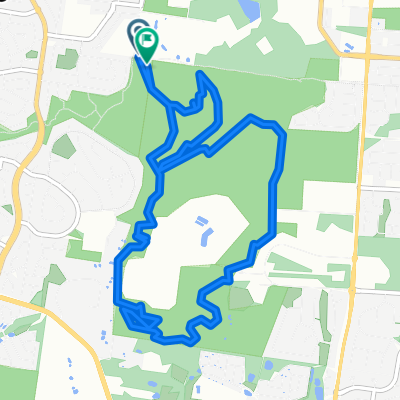
Overview
About this route
- 1 h 50 min
- Duration
- 32.9 km
- Distance
- 314 m
- Ascent
- 307 m
- Descent
- 18 km/h
- Avg. speed
- ---
- Max. altitude
Route quality
Waytypes & surfaces along the route
Waytypes
Quiet road
11.8 km
(36 %)
Cycleway
7.9 km
(24 %)
Surfaces
Paved
30.1 km
(92 %)
Asphalt
23 km
(70 %)
Concrete
5.2 km
(16 %)
Continue with Bikemap
Use, edit, or download this cycling route
You would like to ride Wello to Toowong Village or customize it for your own trip? Here is what you can do with this Bikemap route:
Free features
- Save this route as favorite or in collections
- Copy & plan your own version of this route
- Sync your route with Garmin or Wahoo
Premium features
Free trial for 3 days, or one-time payment. More about Bikemap Premium.
- Navigate this route on iOS & Android
- Export a GPX / KML file of this route
- Create your custom printout (try it for free)
- Download this route for offline navigation
Discover more Premium features.
Get Bikemap PremiumFrom our community
Other popular routes starting in Cleveland
 River Loop
- Distance
- 83.8 km
- Ascent
- 271 m
- Descent
- 288 m
- Location
- Cleveland, Queensland, Australia
 Scribbly to Manly W
- Distance
- 13.5 km
- Ascent
- 121 m
- Descent
- 109 m
- Location
- Cleveland, Queensland, Australia
 Chicks Ride 20190407
- Distance
- 11.3 km
- Ascent
- 114 m
- Descent
- 116 m
- Location
- Cleveland, Queensland, Australia
 Daisy Hill
- Distance
- 78.7 km
- Ascent
- 422 m
- Descent
- 418 m
- Location
- Cleveland, Queensland, Australia
 16–32 Charles Canty Drive, Ormiston to 6 Trio St, Cleveland
- Distance
- 14.3 km
- Ascent
- 240 m
- Descent
- 219 m
- Location
- Cleveland, Queensland, Australia
 Last Ride Before Vacation
- Distance
- 9.8 km
- Ascent
- 52 m
- Descent
- 51 m
- Location
- Cleveland, Queensland, Australia
 SE Bikeway part 2
- Distance
- 24.8 km
- Ascent
- 66 m
- Descent
- 64 m
- Location
- Cleveland, Queensland, Australia
 Thornlands to Cleveland Point
- Distance
- 20.4 km
- Ascent
- 75 m
- Descent
- 71 m
- Location
- Cleveland, Queensland, Australia
Open it in the app