

Wörth-Niederviehbach_Isarbrücke_Kronwieden-Loiching-Schlott-Süßbach-Kirchberg-Setzensack-Adlkofen-Frauenberg-Wolfsbach-Niederaichbach-Wörth
A cycling route starting in Wörth an der Isar, Bavaria, Germany.
Overview
About this route
At Atzbach, turn right onto the gravel path and go approximately 1.5 km until just before Wimpersing, then we will have asphalt again.
- -:--
- Duration
- 48.1 km
- Distance
- 460 m
- Ascent
- 460 m
- Descent
- ---
- Avg. speed
- ---
- Max. altitude

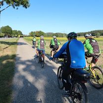
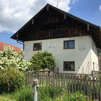
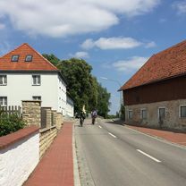
Route photos


Route quality
Waytypes & surfaces along the route
Waytypes
Quiet road
24.5 km
(51 %)
Road
11.5 km
(24 %)
Surfaces
Paved
42.3 km
(88 %)
Unpaved
1.9 km
(4 %)
Asphalt
40.4 km
(84 %)
Concrete
1.9 km
(4 %)
Continue with Bikemap
Use, edit, or download this cycling route
You would like to ride Wörth-Niederviehbach_Isarbrücke_Kronwieden-Loiching-Schlott-Süßbach-Kirchberg-Setzensack-Adlkofen-Frauenberg-Wolfsbach-Niederaichbach-Wörth or customize it for your own trip? Here is what you can do with this Bikemap route:
Free features
- Save this route as favorite or in collections
- Copy & plan your own version of this route
- Sync your route with Garmin or Wahoo
Premium features
Free trial for 3 days, or one-time payment. More about Bikemap Premium.
- Navigate this route on iOS & Android
- Export a GPX / KML file of this route
- Create your custom printout (try it for free)
- Download this route for offline navigation
Discover more Premium features.
Get Bikemap PremiumFrom our community
Other popular routes starting in Wörth an der Isar
 Wörth-Piflas-Flutmulde-Münchnerau-Bruckbergerau-Volkmannsdorf-Moosburger_Stausee-Forster_am_See-Viecht-LA-Piflas-Wörth
- Distance
- 75.5 km
- Ascent
- 104 m
- Descent
- 104 m
- Location
- Wörth an der Isar, Bavaria, Germany
 Wörth-Mengkofen-Haindling-Geiselhöring-Niedersunzing-Wörth_2018
- Distance
- 83.2 km
- Ascent
- 385 m
- Descent
- 388 m
- Location
- Wörth an der Isar, Bavaria, Germany
 Renner_Optimal_Wörth-Seemannshsn.-Oberspechtrain-Frontenhsn.-Obertrennbach-Seemannshsn.-Gangkofen-Aham-Wörth
- Distance
- 76.2 km
- Ascent
- 745 m
- Descent
- 743 m
- Location
- Wörth an der Isar, Bavaria, Germany
 Wörth-Oberwolkersdorf-Winzersdorf-Frauenbiburg-Teisbach-Wörth
- Distance
- 48.8 km
- Ascent
- 408 m
- Descent
- 409 m
- Location
- Wörth an der Isar, Bavaria, Germany
 Wörth-Kronwieden-Rimbach-Ottending-Hofdorf-Weichshofen-Hüttenkofen-Ottering-Thürntenning-Weng-Postau-Wörth
- Distance
- 53 km
- Ascent
- 332 m
- Descent
- 333 m
- Location
- Wörth an der Isar, Bavaria, Germany
 Wörth-Hohenthann-Rottenburg_Industriegebiet-Inkofen-Rohrberg-Ergoldsbach-Siegensdorf-Wörth
- Distance
- 61.3 km
- Ascent
- 509 m
- Descent
- 509 m
- Location
- Wörth an der Isar, Bavaria, Germany
 Wörth-Niederviehbach_Isarbrücke_Kronwieden-Loiching-Schlott-Süßbach-Kirchberg-Setzensack-Adlkofen-Frauenberg-Wolfsbach-Niederaichbach-Wörth
- Distance
- 48.1 km
- Ascent
- 460 m
- Descent
- 460 m
- Location
- Wörth an der Isar, Bavaria, Germany
 Mit Marietta ins süße Leben
- Distance
- 35.7 km
- Ascent
- 694 m
- Descent
- 694 m
- Location
- Wörth an der Isar, Bavaria, Germany
Open it in the app