

S-Möhringen - Nürtingen - Plieningen 52km 580hm
A cycling route starting in Leinfelden-Echterdingen, Baden-Wurttemberg, Germany.
Overview
About this route
Very nice tour through a lot of forest with the highlight of approaching the airport directly onto the runway.
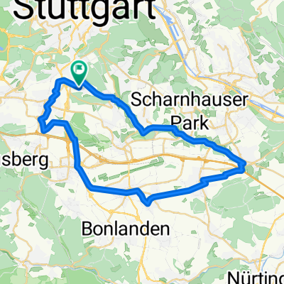
You start in Möhringen heading towards Sieben-Mühlen-Tal. You can either take the western path on the old railway embankment (more forest, but also more strolling pedestrians) or the eastern path (as shown on the map), which runs more through Leinfelden and up on Stettener Höhe.
After Burckhardtsmühle, you go through the forest along the Aich almost to Nürtingen - at the end along the Neckar. In Nürtingen, a detour to Cafe Schümli is recommended, which offers excellent cake (the pralines are 'only' okay).
After a few meters along the Neckar, you then go up to the Lindenhöfen and back into the forest.
Northwest of Neuhausen, you head directly towards the airport's runway and feel like you can touch the planes - impressive! Then you go under the highway and after a sharp bend, you soon arrive at a spot where you can perfectly see/photograph the takeoff or landing of the aircraft. (This route may currently be closed due to construction work on the new railway line, and you just have to go a bit further north to the next opportunity to turn towards Plieningen through the fields.) And then you continue south past Plieningen, back into the forest and return to Möhringen.
- -:--
- Duration
- 50.1 km
- Distance
- 431 m
- Ascent
- 452 m
- Descent
- ---
- Avg. speed
- 462 m
- Max. altitude

Route photos


Route quality
Waytypes & surfaces along the route
Waytypes
Track
29.5 km
(59 %)
Quiet road
9 km
(18 %)
Surfaces
Paved
35.5 km
(71 %)
Unpaved
11.5 km
(23 %)
Asphalt
32 km
(64 %)
Gravel
9.5 km
(19 %)
Continue with Bikemap
Use, edit, or download this cycling route
You would like to ride S-Möhringen - Nürtingen - Plieningen 52km 580hm or customize it for your own trip? Here is what you can do with this Bikemap route:
Free features
- Save this route as favorite or in collections
- Copy & plan your own version of this route
- Sync your route with Garmin or Wahoo
Premium features
Free trial for 3 days, or one-time payment. More about Bikemap Premium.
- Navigate this route on iOS & Android
- Export a GPX / KML file of this route
- Create your custom printout (try it for free)
- Download this route for offline navigation
Discover more Premium features.
Get Bikemap PremiumFrom our community
Other popular routes starting in Leinfelden-Echterdingen
 Hausstrecke
- Distance
- 56.2 km
- Ascent
- 505 m
- Descent
- 482 m
- Location
- Leinfelden-Echterdingen, Baden-Wurttemberg, Germany
 Echterdingen-Betzenberg-Schaichtal
- Distance
- 36.7 km
- Ascent
- 562 m
- Descent
- 565 m
- Location
- Leinfelden-Echterdingen, Baden-Wurttemberg, Germany
 Rund um Böblingen
- Distance
- 65.7 km
- Ascent
- 604 m
- Descent
- 654 m
- Location
- Leinfelden-Echterdingen, Baden-Wurttemberg, Germany
 Möhringen - Sindelfingen/KevinKugel 32km
- Distance
- 32.1 km
- Ascent
- 349 m
- Descent
- 353 m
- Location
- Leinfelden-Echterdingen, Baden-Wurttemberg, Germany
 CMT mittellange Trainingsrunde
- Distance
- 88.7 km
- Ascent
- 673 m
- Descent
- 694 m
- Location
- Leinfelden-Echterdingen, Baden-Wurttemberg, Germany
 Echterdingen, Waldfriedhof Stgt., Bärensee, Solitude
- Distance
- 43.9 km
- Ascent
- 418 m
- Descent
- 418 m
- Location
- Leinfelden-Echterdingen, Baden-Wurttemberg, Germany
 Möhringen - Reutlingen grün 42km 430hm
- Distance
- 42.6 km
- Ascent
- 388 m
- Descent
- 423 m
- Location
- Leinfelden-Echterdingen, Baden-Wurttemberg, Germany
 Rundstrecke Hoffeld-Denkendorf-Hoffeld
- Distance
- 36.7 km
- Ascent
- 238 m
- Descent
- 259 m
- Location
- Leinfelden-Echterdingen, Baden-Wurttemberg, Germany
Open it in the app