P-RTF Über den Binselberg
- 78.8 km
- 383 m
- 385 m
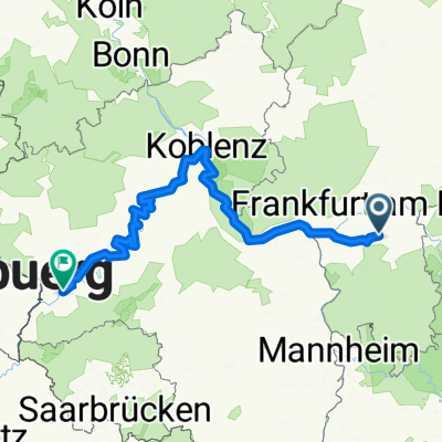
- Dietzenbach, Hesse, Germany
A cycling route starting in Dietzenbach, Hesse, Germany.
Overview
Durch den Rodgau /Hessen geht die Strecke hoch zum Hahnenkamm (Einkehrmöglichkeit für biker am Wochenende). Über eine uralte Höhenstraße werden die getätigten Höhenmeter auf einem netten und schnellen Downhill wieder "abgefahren". Als weiterer Höhepunkt kann die Altstadt mit Burg von Alzenau gesehen werden. Diese Strecke ist nur für MTB geeignet. Mindestkondition notwendig, da sehr kurze, aber sehr steile Uphillpassagen vorhanden sind.
created this 17 years ago
Route quality
Track
35.9 km
(48 %)
Quiet road
13.4 km
(18 %)
Paved
32.1 km
(43 %)
Unpaved
32.1 km
(43 %)
Asphalt
28.4 km
(38 %)
Gravel
20.2 km
(27 %)
Continue with Bikemap
You would like to ride Spessart South-West Part II or customize it for your own trip? Here is what you can do with this Bikemap route:
Free trial for 3 days, or one-time payment. More about Bikemap Premium.
Discover more Premium features.
Get Bikemap PremiumFrom our community
Open it in the app