

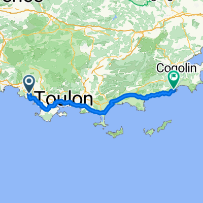
Facile à conduire Bandol
A cycling route starting in Bandol, Provence-Alpes-Côte d'Azur Region, France.
Overview
About this route
- 41 min
- Duration
- 9.3 km
- Distance
- 173 m
- Ascent
- 303 m
- Descent
- 13.6 km/h
- Avg. speed
- ---
- Max. altitude

Route quality
Waytypes & surfaces along the route
Waytypes
Quiet road
4 km
(43 %)
Road
2.6 km
(28 %)
Surfaces
Paved
1.8 km
(19 %)
Unpaved
1.3 km
(14 %)
Asphalt
1.8 km
(19 %)
Unpaved (undefined)
0.7 km
(7 %)
Continue with Bikemap
Use, edit, or download this cycling route
You would like to ride Facile à conduire Bandol or customize it for your own trip? Here is what you can do with this Bikemap route:
Free features
- Save this route as favorite or in collections
- Copy & plan your own version of this route
- Sync your route with Garmin or Wahoo
Premium features
Free trial for 3 days, or one-time payment. More about Bikemap Premium.
- Navigate this route on iOS & Android
- Export a GPX / KML file of this route
- Create your custom printout (try it for free)
- Download this route for offline navigation
Discover more Premium features.
Get Bikemap PremiumFrom our community
Other popular routes starting in Bandol
 Facile à conduire Bandol
- Distance
- 9.3 km
- Ascent
- 173 m
- Descent
- 303 m
- Location
- Bandol, Provence-Alpes-Côte d'Azur Region, France
 le Tour du Roustagon et Bois Morin -Bandol
- Distance
- 12.8 km
- Ascent
- 281 m
- Descent
- 281 m
- Location
- Bandol, Provence-Alpes-Côte d'Azur Region, France
 XPT 14J Bandol - Cavalaire
- Distance
- 86.7 km
- Ascent
- 293 m
- Descent
- 399 m
- Location
- Bandol, Provence-Alpes-Côte d'Azur Region, France
 sommet du gros cerveau
- Distance
- 16.1 km
- Ascent
- 444 m
- Descent
- 84 m
- Location
- Bandol, Provence-Alpes-Côte d'Azur Region, France
 Gros Cerveau et Roustagnon
- Distance
- 14.8 km
- Ascent
- 595 m
- Descent
- 554 m
- Location
- Bandol, Provence-Alpes-Côte d'Azur Region, France
 Pointe du cerveau
- Distance
- 6 km
- Ascent
- 365 m
- Descent
- 106 m
- Location
- Bandol, Provence-Alpes-Côte d'Azur Region, France
 Massif du Cap Sicier
- Distance
- 36 km
- Ascent
- 373 m
- Descent
- 373 m
- Location
- Bandol, Provence-Alpes-Côte d'Azur Region, France
 Bandol 63km
- Distance
- 63.4 km
- Ascent
- 734 m
- Descent
- 736 m
- Location
- Bandol, Provence-Alpes-Côte d'Azur Region, France
Open it in the app