

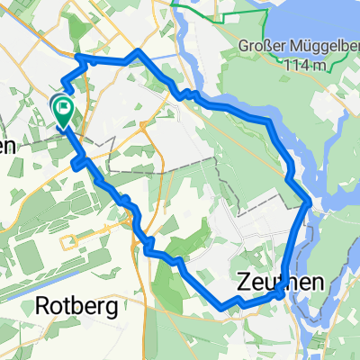
Tollkrug
A cycling route starting in Altglienicke, State of Berlin, Germany.
Overview
About this route
<p>View towards SXF</p>
<p>Low traffic</p>
<p>nice 40 km loop</p>
Translated, show original (German)- -:--
- Duration
- 39.9 km
- Distance
- 40 m
- Ascent
- 42 m
- Descent
- ---
- Avg. speed
- ---
- Max. altitude
Route quality
Waytypes & surfaces along the route
Waytypes
Road
11.2 km
(28 %)
Path
9.6 km
(24 %)
Surfaces
Paved
36.3 km
(91 %)
Unpaved
0.4 km
(1 %)
Asphalt
36.3 km
(91 %)
Ground
0.4 km
(1 %)
Undefined
3.2 km
(8 %)
Continue with Bikemap
Use, edit, or download this cycling route
You would like to ride Tollkrug or customize it for your own trip? Here is what you can do with this Bikemap route:
Free features
- Save this route as favorite or in collections
- Copy & plan your own version of this route
- Sync your route with Garmin or Wahoo
Premium features
Free trial for 3 days, or one-time payment. More about Bikemap Premium.
- Navigate this route on iOS & Android
- Export a GPX / KML file of this route
- Create your custom printout (try it for free)
- Download this route for offline navigation
Discover more Premium features.
Get Bikemap PremiumFrom our community
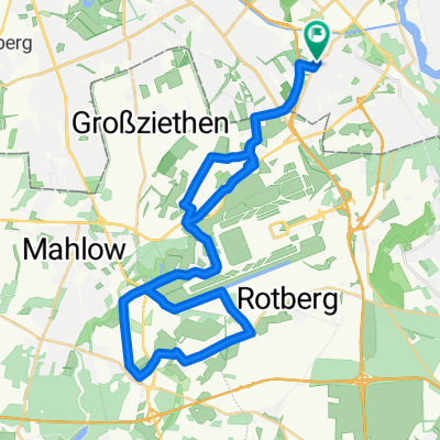
Other popular routes starting in Altglienicke
 Von S Altglienicke nach S Adlershof immer schön durchs Grüne
- Distance
- 46.7 km
- Ascent
- 206 m
- Descent
- 213 m
- Location
- Altglienicke, State of Berlin, Germany
 Einmal um Schönefeld
- Distance
- 30.8 km
- Ascent
- 54 m
- Descent
- 55 m
- Location
- Altglienicke, State of Berlin, Germany
 Rund um Rudow Süd
- Distance
- 22.2 km
- Ascent
- 24 m
- Descent
- 24 m
- Location
- Altglienicke, State of Berlin, Germany
 große
große- Distance
- 35.2 km
- Ascent
- 39 m
- Descent
- 38 m
- Location
- Altglienicke, State of Berlin, Germany
 BER Umrundung bereinigt
- Distance
- 136.9 km
- Ascent
- 146 m
- Descent
- 143 m
- Location
- Altglienicke, State of Berlin, Germany
 Müggelseerunde mit Müggelberg
- Distance
- 47 km
- Ascent
- 91 m
- Descent
- 91 m
- Location
- Altglienicke, State of Berlin, Germany
 Berlin- Brandenburg Airportwatch...
- Distance
- 35.7 km
- Ascent
- 77 m
- Descent
- 75 m
- Location
- Altglienicke, State of Berlin, Germany
 Tollkrug
- Distance
- 39.9 km
- Ascent
- 40 m
- Descent
- 42 m
- Location
- Altglienicke, State of Berlin, Germany
Open it in the app