Hemfurth - Mandern und zurück
- 26 km
- 62 m
- 113 m
- Waldeck, Hesse, Germany
A cycling route starting in Waldeck, Hesse, Germany.
Overview
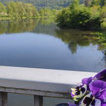
Short description: Waldeck/Castle parking lot – Bahnhofstrasse – Buhlen - Affoldern – northern shore of Affolderner See – Hemfurth – Rehbach – dam – Waldeck-West – Nieder-Werbe – golf course - Waldeck
Route length: 37.5 km
Elevation gain: 280 m
Difficulty level: medium
Route description: The ER 63 is mostly paved and therefore suitable even for bad weather periods
Castle parking lot - Bahnhofstrasse – station – new bike path on old railway track – 'Bahnhof Buhlen' - Affoldern – along the northern shore of Affolderner See to Hemfurth - bike path to Rehbach – from Rehbach a nice, low-traffic riverside bike path to the dam – from the dam a new paved panoramic bike path next to the shore road to Nieder-Werbe – through the Nieder-Werbe fields steeply uphill on a paved field road to the forest edge – from here it gets flatter but the path quality also worsens – from August-Schwarzer-Hütte mostly flat path past the golf course with beautiful panoramic views over the mid-mountain landscape – with slight ups and downs you pass through Waldeck again and return to the castle parking lot.
Shortcut option: by ferry from Rehbach to Scheid and possibly return on the shore bike path to Waldeck-West and by cable car to Waldeck and the castle
Refreshment options: in Affoldern, Hemfurth, Rehbach, at the dam, Waldeck-West, Nieder-Werbe, golf course restaurant, Waldeck
created this 15 years ago
Route highlights
Continue with Bikemap
You would like to ride Ederseeradweg ER 63 or customize it for your own trip? Here is what you can do with this Bikemap route:
Free trial for 3 days, or one-time payment. More about Bikemap Premium.
Discover more Premium features.
Get Bikemap PremiumFrom our community
Open it in the app