

Okolo Lipnice
A cycling route starting in Světlá nad Sázavou, Kraj Vysočina, Czechia.
Overview
About this route
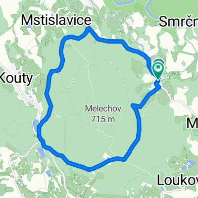
The route initially follows class II and III roads, mainly in its first half, where there is a nice view of Lipnice Castle. From Kejžlice, the route goes along a forest path to the Orlov hunting lodge and then through the Orlov forests back under Lipnice Castle, where the path joins the III class road and leads back to Světlá.
- -:--
- Duration
- 31 km
- Distance
- 330 m
- Ascent
- 330 m
- Descent
- ---
- Avg. speed
- ---
- Max. altitude

Route quality
Waytypes & surfaces along the route
Waytypes
Road
12.4 km
(40 %)
Track
7.1 km
(23 %)
Surfaces
Paved
11.8 km
(38 %)
Unpaved
6.8 km
(22 %)
Asphalt
11.8 km
(38 %)
Unpaved (undefined)
3.4 km
(11 %)
Continue with Bikemap
Use, edit, or download this cycling route
You would like to ride Okolo Lipnice or customize it for your own trip? Here is what you can do with this Bikemap route:
Free features
- Save this route as favorite or in collections
- Copy & plan your own version of this route
- Sync your route with Garmin or Wahoo
Premium features
Free trial for 3 days, or one-time payment. More about Bikemap Premium.
- Navigate this route on iOS & Android
- Export a GPX / KML file of this route
- Create your custom printout (try it for free)
- Download this route for offline navigation
Discover more Premium features.
Get Bikemap PremiumFrom our community
Other popular routes starting in Světlá nad Sázavou
 Koňkovice-Melechov
- Distance
- 9.7 km
- Ascent
- 274 m
- Descent
- 275 m
- Location
- Světlá nad Sázavou, Kraj Vysočina, Czechia
 Smrcna - Lipnice - Humpolec - Smrcna
- Distance
- 41.8 km
- Ascent
- 727 m
- Descent
- 727 m
- Location
- Světlá nad Sázavou, Kraj Vysočina, Czechia
 Světlá n.S - Habry - Vilémov - Ronov n.D. - Přelouč
- Distance
- 55.5 km
- Ascent
- 446 m
- Descent
- 628 m
- Location
- Světlá nad Sázavou, Kraj Vysočina, Czechia
 Podél Sázavy
- Distance
- 161.6 km
- Ascent
- 762 m
- Descent
- 951 m
- Location
- Světlá nad Sázavou, Kraj Vysočina, Czechia
 MeziKlasyTour
- Distance
- 86.6 km
- Ascent
- 687 m
- Descent
- 698 m
- Location
- Světlá nad Sázavou, Kraj Vysočina, Czechia
 Světlá - Horní paseky - Světlá
- Distance
- 28.6 km
- Ascent
- 406 m
- Descent
- 403 m
- Location
- Světlá nad Sázavou, Kraj Vysočina, Czechia
 Smrcna - Lipnice - Humpolec - Kojcice - Sedlice - Melechov - Smrcna
- Distance
- 81.4 km
- Ascent
- 953 m
- Descent
- 952 m
- Location
- Světlá nad Sázavou, Kraj Vysočina, Czechia
 Biciklitúra 2015. 5. nap
- Distance
- 51.3 km
- Ascent
- 404 m
- Descent
- 387 m
- Location
- Světlá nad Sázavou, Kraj Vysočina, Czechia
Open it in the app