

Straubing
Wörth-Laberweinting-SR_Laabertal_Hagen
A cycling route starting in Wörth an der Isar, Bavaria, Germany.
Overview
About this route
In Radldorf turn right and leave the Laabertalradweg (a bit shorter) until Rinkam, where you reconnect with the bike path next to the B8 and continue.
North past the Tiergarten, really great all the way to the ice stadium, everything is zone 30 (Gartenstraße). Then it gets a bit confusing from Hagen and onwards to the Klinikum. After Hagen, I went up Rentamtsberg, Fürstenstraße, Schlossplatz to Uferstraße, here there are coarse cobblestones and it's not so great. That's why I redirected the route directly to the Danube here!
- -:--
- Duration
- 51.5 km
- Distance
- 183 m
- Ascent
- 224 m
- Descent
- ---
- Avg. speed
- ---
- Max. altitude

Part of
4 stages
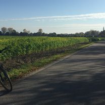
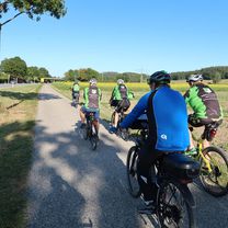
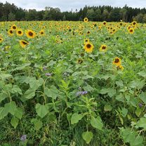
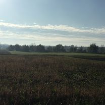
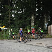
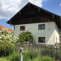
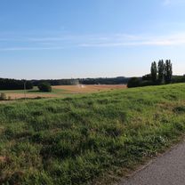
Route photos


Route quality
Waytypes & surfaces along the route
Waytypes
Quiet road
24.7 km
(48 %)
Road
18.5 km
(36 %)
Surfaces
Paved
22.7 km
(44 %)
Asphalt
20.6 km
(40 %)
Paved (undefined)
2.1 km
(4 %)
Undefined
28.8 km
(56 %)
Continue with Bikemap
Use, edit, or download this cycling route
You would like to ride Wörth-Laberweinting-SR_Laabertal_Hagen or customize it for your own trip? Here is what you can do with this Bikemap route:
Free features
- Save this route as favorite or in collections
- Copy & plan your own version of this route
- Sync your route with Garmin or Wahoo
Premium features
Free trial for 3 days, or one-time payment. More about Bikemap Premium.
- Navigate this route on iOS & Android
- Export a GPX / KML file of this route
- Create your custom printout (try it for free)
- Download this route for offline navigation
Discover more Premium features.
Get Bikemap PremiumFrom our community
Other popular routes starting in Wörth an der Isar
 Wörth-Piflas-Flutmulde-Münchnerau-Bruckbergerau-Volkmannsdorf-Moosburger_Stausee-Forster_am_See-Viecht-LA-Piflas-Wörth
- Distance
- 75.5 km
- Ascent
- 104 m
- Descent
- 104 m
- Location
- Wörth an der Isar, Bavaria, Germany
 Wörth-Niederviehbach-Gummering-Loiching-Bergham-Teisbach-Oberteisbach-Maßendorf-Weigendorf-Süßbach-Schlott-Gummering-Wörth
- Distance
- 27.9 km
- Ascent
- 292 m
- Descent
- 292 m
- Location
- Wörth an der Isar, Bavaria, Germany
 Wörth-Oberwolkersdorf-Winzersdorf-Frauenbiburg-Teisbach-Wörth
- Distance
- 48.8 km
- Ascent
- 408 m
- Descent
- 409 m
- Location
- Wörth an der Isar, Bavaria, Germany
 Wörth-Laberweinting-SR_Laabertal_Hagen
- Distance
- 51.5 km
- Ascent
- 183 m
- Descent
- 224 m
- Location
- Wörth an der Isar, Bavaria, Germany
 Wörth-Kronwieden-Loiching-Süßbach-Weigendorf-Göttersdorf-Wieselsberg-Otzlberg-Triendorf-Oberaichbach-Niederaichbach-Wörth
- Distance
- 37.4 km
- Ascent
- 328 m
- Descent
- 330 m
- Location
- Wörth an der Isar, Bavaria, Germany
 Renner_Optimal_Wörth-Seemannshsn.-Oberspechtrain-Frontenhsn.-Obertrennbach-Seemannshsn.-Gangkofen-Aham-Wörth
- Distance
- 76.2 km
- Ascent
- 745 m
- Descent
- 743 m
- Location
- Wörth an der Isar, Bavaria, Germany
 Wörth-Niederviehbach-Hattenkofen-Wimpersing-Lichteneck-Otzlberg-Großbettenrain-Triendorf-Postreit-Oberaichbach-Wörth
- Distance
- 34.2 km
- Ascent
- 230 m
- Descent
- 230 m
- Location
- Wörth an der Isar, Bavaria, Germany
 Wörth-Kronwieden-Rimbach-Ottending-Hofdorf-Weichshofen-Hüttenkofen-Ottering-Thürntenning-Weng-Postau-Wörth
- Distance
- 53 km
- Ascent
- 332 m
- Descent
- 333 m
- Location
- Wörth an der Isar, Bavaria, Germany
Open it in the app