

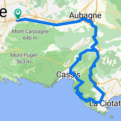
Gineste-Carnoux-Roquefort-col de l' Ange-Gèmenos
A cycling route starting in Marseille 11, Provence-Alpes-Côte d'Azur Region, France.
Overview
About this route
2 main climbs: La Gineste from Marseille (5 km at 4.7% average and 8% max) Climb from Cassis to Carnoux (2 km at 7% average and 9% max)
- -:--
- Duration
- 61 km
- Distance
- 653 m
- Ascent
- 653 m
- Descent
- ---
- Avg. speed
- ---
- Max. altitude
Route quality
Waytypes & surfaces along the route
Waytypes
Quiet road
7.9 km
(13 %)
Road
3.7 km
(6 %)
Surfaces
Paved
36 km
(59 %)
Asphalt
34.8 km
(57 %)
Concrete
1.2 km
(2 %)
Undefined
25 km
(41 %)
Continue with Bikemap
Use, edit, or download this cycling route
You would like to ride Gineste-Carnoux-Roquefort-col de l' Ange-Gèmenos or customize it for your own trip? Here is what you can do with this Bikemap route:
Free features
- Save this route as favorite or in collections
- Copy & plan your own version of this route
- Sync your route with Garmin or Wahoo
Premium features
Free trial for 3 days, or one-time payment. More about Bikemap Premium.
- Navigate this route on iOS & Android
- Export a GPX / KML file of this route
- Create your custom printout (try it for free)
- Download this route for offline navigation
Discover more Premium features.
Get Bikemap PremiumFrom our community
Other popular routes starting in Marseille 11
 La Ciotat par la Route des Crètes
- Distance
- 66.5 km
- Ascent
- 870 m
- Descent
- 869 m
- Location
- Marseille 11, Provence-Alpes-Côte d'Azur Region, France
 Projet III
- Distance
- 107.5 km
- Ascent
- 1,594 m
- Descent
- 1,593 m
- Location
- Marseille 11, Provence-Alpes-Côte d'Azur Region, France
 Gineste-Carnoux-Roquefort-col de l' Ange-Gèmenos
- Distance
- 61 km
- Ascent
- 653 m
- Descent
- 653 m
- Location
- Marseille 11, Provence-Alpes-Côte d'Azur Region, France
 Projet II
- Distance
- 118 km
- Ascent
- 1,284 m
- Descent
- 1,284 m
- Location
- Marseille 11, Provence-Alpes-Côte d'Azur Region, France
 Projet
- Distance
- 97.5 km
- Ascent
- 1,084 m
- Descent
- 1,086 m
- Location
- Marseille 11, Provence-Alpes-Côte d'Azur Region, France
 Mont Saint-Cyr
- Distance
- 3.4 km
- Ascent
- 540 m
- Descent
- 23 m
- Location
- Marseille 11, Provence-Alpes-Côte d'Azur Region, France
 GR2013 Région de Marseille
- Distance
- 368.2 km
- Ascent
- 2,568 m
- Descent
- 2,455 m
- Location
- Marseille 11, Provence-Alpes-Côte d'Azur Region, France
 Marseille - Géménos - Plan d'Aups - Auriol - Roquevaire - Marseille (via Éoures)
- Distance
- 71.3 km
- Ascent
- 853 m
- Descent
- 853 m
- Location
- Marseille 11, Provence-Alpes-Côte d'Azur Region, France
Open it in the app