

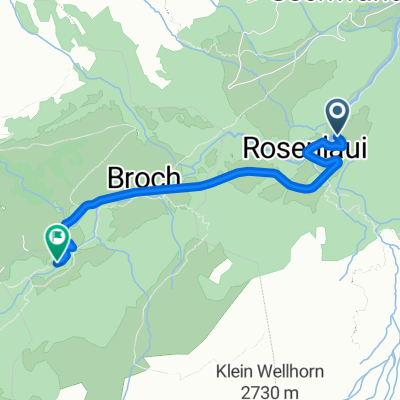
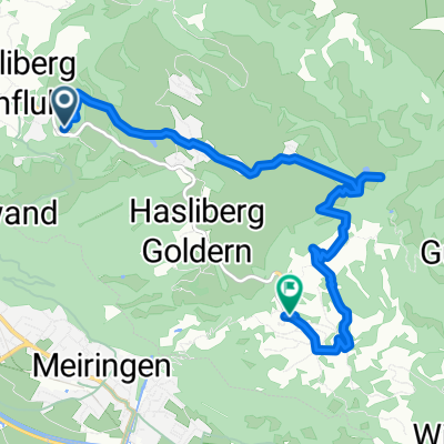
02 Day2 Meiringen to Hospental
A cycling route starting in Meiringen, Canton of Bern, Switzerland.
Overview
About this route
Low mileage, high effort. I would not have guessed that a 65km day could take so long or exhaust so much.
- -:--
- Duration
- 68.9 km
- Distance
- 2,297 m
- Ascent
- 1,399 m
- Descent
- ---
- Avg. speed
- ---
- Max. altitude

Route quality
Waytypes & surfaces along the route
Waytypes
Track
2.1 km
(3 %)
Quiet road
1.4 km
(2 %)
Surfaces
Paved
64.8 km
(94 %)
Unpaved
2.8 km
(4 %)
Asphalt
64.8 km
(94 %)
Gravel
1.4 km
(2 %)
Continue with Bikemap
Use, edit, or download this cycling route
You would like to ride 02 Day2 Meiringen to Hospental or customize it for your own trip? Here is what you can do with this Bikemap route:
Free features
- Save this route as favorite or in collections
- Copy & plan your own version of this route
- Sync your route with Garmin or Wahoo
Premium features
Free trial for 3 days, or one-time payment. More about Bikemap Premium.
- Navigate this route on iOS & Android
- Export a GPX / KML file of this route
- Create your custom printout (try it for free)
- Download this route for offline navigation
Discover more Premium features.
Get Bikemap PremiumFrom our community
Other popular routes starting in Meiringen
 Englerweg 4a nach Lengenacherstrasse
- Distance
- 39.8 km
- Ascent
- 1,191 m
- Descent
- 1,217 m
- Location
- Meiringen, Canton of Bern, Switzerland
 Grosse Scheidegg rondtour Z-variant
- Distance
- 84 km
- Ascent
- 1,618 m
- Descent
- 2,342 m
- Location
- Meiringen, Canton of Bern, Switzerland
 1. Grosse Scheidegg
- Distance
- 97.8 km
- Ascent
- 1,954 m
- Descent
- 1,950 m
- Location
- Meiringen, Canton of Bern, Switzerland
 Hauptstrasse, Meiringen nach Jungfraustrasse 14, Thun
- Distance
- 56.3 km
- Ascent
- 792 m
- Descent
- 812 m
- Location
- Meiringen, Canton of Bern, Switzerland
 Rosenlaui-Feuerstellen
- Distance
- 3.1 km
- Ascent
- 177 m
- Descent
- 19 m
- Location
- Meiringen, Canton of Bern, Switzerland
 Alpenbreve Gold
- Distance
- 161.7 km
- Ascent
- 4,980 m
- Descent
- 4,213 m
- Location
- Meiringen, Canton of Bern, Switzerland
 Hasliberg - Kugelweg
- Distance
- 7.8 km
- Ascent
- 446 m
- Descent
- 465 m
- Location
- Meiringen, Canton of Bern, Switzerland
 Allmendstrasse 5, Meiringen nach Allmendstrasse 9, Meiringen
- Distance
- 54.5 km
- Ascent
- 1,490 m
- Descent
- 1,486 m
- Location
- Meiringen, Canton of Bern, Switzerland
Open it in the app