
Koetter Skyline 40
A cycling route starting in Galena, Indiana, United States.
Overview
About this route
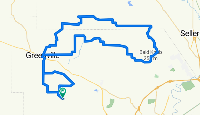
Skyline Drive with rendevous at Koetter & return thru Greenville
- -:--
- Duration
- 64.9 km
- Distance
- 381 m
- Ascent
- 381 m
- Descent
- ---
- Avg. speed
- ---
- Max. altitude
Route quality
Waytypes & surfaces along the route
Waytypes
Quiet road
63 km
(97 %)
Road
1.9 km
(3 %)
Surfaces
Paved
24.7 km
(38 %)
Paved (undefined)
20.8 km
(32 %)
Asphalt
3.9 km
(6 %)
Undefined
40.2 km
(62 %)
Continue with Bikemap
Use, edit, or download this cycling route
You would like to ride Koetter Skyline 40 or customize it for your own trip? Here is what you can do with this Bikemap route:
Free features
- Save this route as favorite or in collections
- Copy & plan your own version of this route
- Sync your route with Garmin or Wahoo
Premium features
Free trial for 3 days, or one-time payment. More about Bikemap Premium.
- Navigate this route on iOS & Android
- Export a GPX / KML file of this route
- Create your custom printout (try it for free)
- Download this route for offline navigation
Discover more Premium features.
Get Bikemap PremiumFrom our community
Other popular routes starting in Galena
 Reverse 32
- Distance
- 51.9 km
- Ascent
- 268 m
- Descent
- 267 m
- Location
- Galena, Indiana, United States
 Star Valley St. Mary's 2
- Distance
- 56.1 km
- Ascent
- 367 m
- Descent
- 367 m
- Location
- Galena, Indiana, United States
 Corydon A
- Distance
- 68.3 km
- Ascent
- 372 m
- Descent
- 372 m
- Location
- Galena, Indiana, United States
 Bradford Option 35
- Distance
- 56.9 km
- Ascent
- 238 m
- Descent
- 238 m
- Location
- Galena, Indiana, United States
 Koetter Skyline 40
- Distance
- 64.9 km
- Ascent
- 381 m
- Descent
- 381 m
- Location
- Galena, Indiana, United States
 FCHS Regular Loop
- Distance
- 30.2 km
- Ascent
- 236 m
- Descent
- 239 m
- Location
- Galena, Indiana, United States
 hubers
- Distance
- 17.6 km
- Ascent
- 122 m
- Descent
- 132 m
- Location
- Galena, Indiana, United States
 Hancock Chapel
- Distance
- 57.7 km
- Ascent
- 328 m
- Descent
- 328 m
- Location
- Galena, Indiana, United States
Open it in the app