

Monte Zoncolan
A cycling route starting in Ovaro, Friuli Venezia Giulia, Italy.
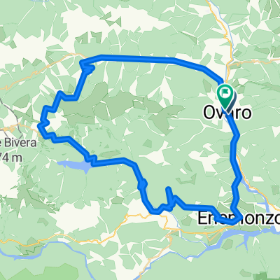
Overview
About this route
Westanfahrt von Ovaro seit 2007 neu asphaltiert
3 Tunnel im oberen Bereich (beleuchtet)<br />
Anstieg 10,5 km lang (525 m -> 1750 m üNN)<br />
durchschnittliche Steigung auf 6 km Länge 14,9 %!!!<br />
maximale Steigung 23 %
bei Rennrädern 3-fach-Kettenblatt bzw. Kompaktkurbel erforderlich!
- -:--
- Duration
- 43 km
- Distance
- 1,922 m
- Ascent
- 1,892 m
- Descent
- ---
- Avg. speed
- 1,731 m
- Avg. speed

Route quality
Waytypes & surfaces along the route
Waytypes
Busy road
19.1 km
(45 %)
Quiet road
11.8 km
(27 %)
Surfaces
Paved
22.4 km
(52 %)
Asphalt
22.4 km
(52 %)
Undefined
20.6 km
(48 %)
Continue with Bikemap
Use, edit, or download this cycling route
You would like to ride Monte Zoncolan or customize it for your own trip? Here is what you can do with this Bikemap route:
Free features
- Save this route as favorite or in collections
- Copy & plan your own version of this route
- Sync your route with Garmin or Wahoo
Premium features
Free trial for 3 days, or one-time payment. More about Bikemap Premium.
- Navigate this route on iOS & Android
- Export a GPX / KML file of this route
- Create your custom printout (try it for free)
- Download this route for offline navigation
Discover more Premium features.
Get Bikemap PremiumFrom our community
Other popular routes starting in Ovaro
 Ovaro_Voltois_Sauris
- Distance
- 71.3 km
- Ascent
- 2,211 m
- Descent
- 2,234 m
- Location
- Ovaro, Friuli Venezia Giulia, Italy
 006 Monte Zoncolan
- Distance
- 136.5 km
- Ascent
- 1,402 m
- Descent
- 1,978 m
- Location
- Ovaro, Friuli Venezia Giulia, Italy
 ZONCOLAN
- Distance
- 9.8 km
- Ascent
- 1,213 m
- Descent
- 22 m
- Location
- Ovaro, Friuli Venezia Giulia, Italy
 Projecte 1A
- Distance
- 499.6 km
- Ascent
- 9,717 m
- Descent
- 9,680 m
- Location
- Ovaro, Friuli Venezia Giulia, Italy
 1 - OVARO A (Zoncolan)
- Distance
- 60.9 km
- Ascent
- 1,800 m
- Descent
- 1,799 m
- Location
- Ovaro, Friuli Venezia Giulia, Italy
 mione sauris pesaris
- Distance
- 56.8 km
- Ascent
- 2,129 m
- Descent
- 2,136 m
- Location
- Ovaro, Friuli Venezia Giulia, Italy
 Monte crostis
- Distance
- 49.5 km
- Ascent
- 1,647 m
- Descent
- 1,606 m
- Location
- Ovaro, Friuli Venezia Giulia, Italy
 2 - OVARO - OVARO A (Crostis)
- Distance
- 53.2 km
- Ascent
- 1,814 m
- Descent
- 1,821 m
- Location
- Ovaro, Friuli Venezia Giulia, Italy
Open it in the app