

MㄒB龍崎
A cycling route starting in Tainan City, Taiwan, Taiwan.
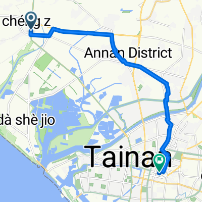
Overview
About this route
- 4 h 44 min
- Duration
- 48.3 km
- Distance
- 237 m
- Ascent
- 237 m
- Descent
- 10.2 km/h
- Avg. speed
- ---
- Max. altitude

Route photos


Continue with Bikemap
Use, edit, or download this cycling route
You would like to ride MㄒB龍崎 or customize it for your own trip? Here is what you can do with this Bikemap route:
Free features
- Save this route as favorite or in collections
- Copy & plan your own version of this route
- Sync your route with Garmin or Wahoo
Premium features
Free trial for 3 days, or one-time payment. More about Bikemap Premium.
- Navigate this route on iOS & Android
- Export a GPX / KML file of this route
- Create your custom printout (try it for free)
- Download this route for offline navigation
Discover more Premium features.
Get Bikemap PremiumFrom our community
Other popular routes starting in Tainan City
 201212/01-二寮行
- Distance
- 39.6 km
- Ascent
- 292 m
- Descent
- 292 m
- Location
- Tainan City, Taiwan, Taiwan
 Tainan City - Tainan City
- Distance
- 15.4 km
- Ascent
- 70 m
- Descent
- 60 m
- Location
- Tainan City, Taiwan, Taiwan
 MㄒB龍崎
MㄒB龍崎- Distance
- 48.3 km
- Ascent
- 237 m
- Descent
- 237 m
- Location
- Tainan City, Taiwan, Taiwan
 漁光島
漁光島- Distance
- 6 km
- Ascent
- 25 m
- Descent
- 34 m
- Location
- Tainan City, Taiwan, Taiwan
 20100123 台南高鐵-旗山-美濃-三地們-屏東
- Distance
- 106.5 km
- Ascent
- 690 m
- Descent
- 610 m
- Location
- Tainan City, Taiwan, Taiwan
 二寮,新化進關廟出
- Distance
- 50.2 km
- Ascent
- 280 m
- Descent
- 280 m
- Location
- Tainan City, Taiwan, Taiwan
 仁德到玉井層林
- Distance
- 72.4 km
- Ascent
- 2,721 m
- Descent
- 2,737 m
- Location
- Tainan City, Taiwan, Taiwan
 2012 休閒觀光組
- Distance
- 164.4 km
- Ascent
- 271 m
- Descent
- 266 m
- Location
- Tainan City, Taiwan, Taiwan
Open it in the app