
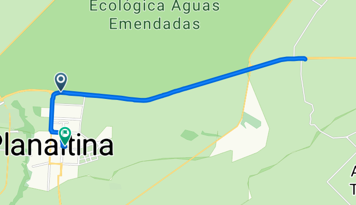
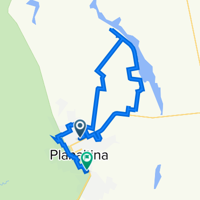
ml posto de São Rock
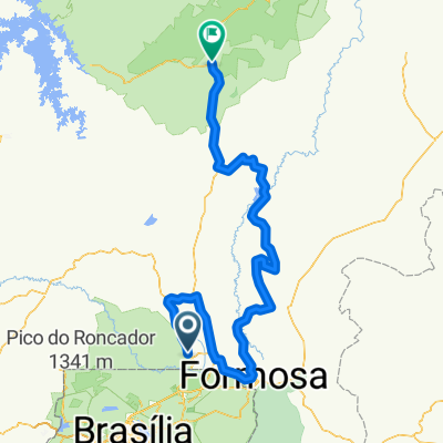
A cycling route starting in Planaltina, Goiás, Brazil.
Overview
About this route
- 2 h 3 min
- Duration
- 25.9 km
- Distance
- 653 m
- Ascent
- 642 m
- Descent
- 12.7 km/h
- Avg. speed
- ---
- Avg. speed

Continue with Bikemap
Use, edit, or download this cycling route
You would like to ride ml posto de São Rock or customize it for your own trip? Here is what you can do with this Bikemap route:
Free features
- Save this route as favorite or in collections
- Copy & plan your own version of this route
- Sync your route with Garmin or Wahoo
Premium features
Free trial for 3 days, or one-time payment. More about Bikemap Premium.
- Navigate this route on iOS & Android
- Export a GPX / KML file of this route
- Create your custom printout (try it for free)
- Download this route for offline navigation
Discover more Premium features.
Get Bikemap PremiumFrom our community
Other popular routes starting in Planaltina
 De Quadra 19 MR 4 29 a Quadra 5 MR 12 lote 17
- Distance
- 35.8 km
- Ascent
- 386 m
- Descent
- 419 m
- Location
- Planaltina, Goiás, Brazil
 ml posto de São Rock
- Distance
- 25.9 km
- Ascent
- 653 m
- Descent
- 642 m
- Location
- Planaltina, Goiás, Brazil
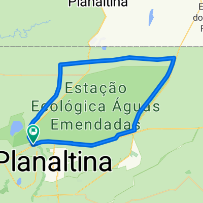 Volta Da Est. Ecológica Águas Emendadas.
- Distance
- 43.7 km
- Ascent
- 413 m
- Descent
- 413 m
- Location
- Planaltina, Goiás, Brazil
 Volta Est. Ecológica Águas Emendadas
- Distance
- 43.8 km
- Ascent
- 411 m
- Descent
- 411 m
- Location
- Planaltina, Goiás, Brazil
 extreme brasilinha formosa alto paraiso
- Distance
- 345.4 km
- Ascent
- 1,915 m
- Descent
- 1,670 m
- Location
- Planaltina, Goiás, Brazil
 Rota constante em Brasília
- Distance
- 12.1 km
- Ascent
- 321 m
- Descent
- 151 m
- Location
- Planaltina, Goiás, Brazil
 Planaltina df a emida dom Bosco
- Distance
- 52.5 km
- Ascent
- 502 m
- Descent
- 447 m
- Location
- Planaltina, Goiás, Brazil
 Caminhada intensa em Brasília
- Distance
- 30.8 km
- Ascent
- 171 m
- Descent
- 172 m
- Location
- Planaltina, Goiás, Brazil
Open it in the app