


Baumschulweg, Öhringen nach Im Birkenwald, Stuttgart
- 64.5 km
- 747 m
- 696 m
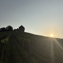
- Öhringen, Baden-Wurttemberg, Germany
2020 Kocher-Jagst
A cycling route starting in Öhringen, Baden-Wurttemberg, Germany.
Overview
created this 6 years ago
Part of
7 stages
Route quality
Quiet road
30.1 km
(35 %)
Road
22.4 km
(26 %)
Paved
67.1 km
(78 %)
Unpaved
5.2 km
(6 %)
Asphalt
65.3 km
(76 %)
Gravel
2.6 km
(3 %)
Continue with Bikemap
You would like to ride Burgenweg - Schwäwisch Hall or customize it for your own trip? Here is what you can do with this Bikemap route:
Free trial for 3 days, or one-time payment. More about Bikemap Premium.
Discover more Premium features.
Get Bikemap PremiumFrom our community
Open it in the app


