

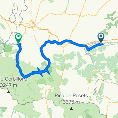
R19 Saint Gaudens - TOURMALET - Lourdes
A cycling route starting in Saint-Gaudens, Occitanie, France.
Overview
About this route
R19 Saint Gaudens - TOURMALET - Lourdes
- -:--
- Duration
- 136.4 km
- Distance
- 2,821 m
- Ascent
- 2,839 m
- Descent
- ---
- Avg. speed
- 2,119 m
- Max. altitude

Route quality
Waytypes & surfaces along the route
Waytypes
Quiet road
23.2 km
(17 %)
Road
21.8 km
(16 %)
Surfaces
Paved
83.2 km
(61 %)
Unpaved
1.4 km
(1 %)
Asphalt
83.2 km
(61 %)
Ground
1.4 km
(1 %)
Undefined
51.8 km
(38 %)
Continue with Bikemap
Use, edit, or download this cycling route
You would like to ride R19 Saint Gaudens - TOURMALET - Lourdes or customize it for your own trip? Here is what you can do with this Bikemap route:
Free features
- Save this route as favorite or in collections
- Copy & plan your own version of this route
- Split it into stages to create a multi-day tour
- Sync your route with Garmin or Wahoo
Premium features
Free trial for 3 days, or one-time payment. More about Bikemap Premium.
- Navigate this route on iOS & Android
- Export a GPX / KML file of this route
- Create your custom printout (try it for free)
- Download this route for offline navigation
Discover more Premium features.
Get Bikemap PremiumFrom our community
Other popular routes starting in Saint-Gaudens
 2014 Ride Day 41 - St-Gaudens (Estancarbon) to Foix
- Distance
- 95.8 km
- Ascent
- 514 m
- Descent
- 498 m
- Location
- Saint-Gaudens, Occitanie, France
 09-D. Saint-Gaudens - Plateau de Beille (169 Km)
- Distance
- 169 km
- Ascent
- 5,846 m
- Descent
- 4,459 m
- Location
- Saint-Gaudens, Occitanie, France
 2014 Ride Day 86 - St-Gaudens to l'Isle Jourdain
- Distance
- 98.1 km
- Ascent
- 361 m
- Descent
- 587 m
- Location
- Saint-Gaudens, Occitanie, France
 Tour de France - Etappe 14
- Distance
- 169.3 km
- Ascent
- 4,219 m
- Descent
- 2,796 m
- Location
- Saint-Gaudens, Occitanie, France
 R19 Saint Gaudens - TOURMALET - Lourdes
- Distance
- 136.4 km
- Ascent
- 2,821 m
- Descent
- 2,839 m
- Location
- Saint-Gaudens, Occitanie, France
- ddjk
- Distance
- 67.7 km
- Ascent
- ---
- Descent
- ---
- Location
- Saint-Gaudens, Occitanie, France
 Saint-Gaudens - AURIGNAC - MANCIOUX - ST GAUDENS
- Distance
- 59 km
- Ascent
- 386 m
- Descent
- 386 m
- Location
- Saint-Gaudens, Occitanie, France
 2016 Ride Day 55 - St-Gaudens to Pamiers
- Distance
- 118.8 km
- Ascent
- 544 m
- Descent
- 638 m
- Location
- Saint-Gaudens, Occitanie, France
Open it in the app