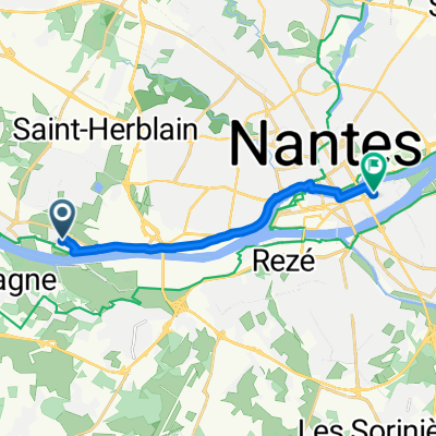
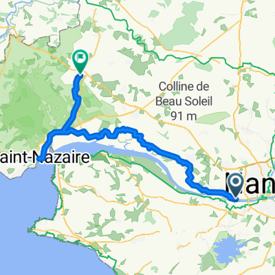
Circuit VTT Coueron
A cycling route starting in Indre, Pays de la Loire Region, France.
Overview
About this route
Préparation de sortie
- -:--
- Duration
- 31.9 km
- Distance
- 191 m
- Ascent
- 192 m
- Descent
- ---
- Avg. speed
- ---
- Avg. speed
Route quality
Waytypes & surfaces along the route
Waytypes
Path
12.8 km
(40 %)
Quiet road
8.5 km
(27 %)
Surfaces
Paved
2.8 km
(9 %)
Unpaved
6.6 km
(21 %)
Ground
4.8 km
(15 %)
Asphalt
2.5 km
(8 %)
Continue with Bikemap
Use, edit, or download this cycling route
You would like to ride Circuit VTT Coueron or customize it for your own trip? Here is what you can do with this Bikemap route:
Free features
- Save this route as favorite or in collections
- Copy & plan your own version of this route
- Sync your route with Garmin or Wahoo
Premium features
Free trial for 3 days, or one-time payment. More about Bikemap Premium.
- Navigate this route on iOS & Android
- Export a GPX / KML file of this route
- Create your custom printout (try it for free)
- Download this route for offline navigation
Discover more Premium features.
Get Bikemap PremiumFrom our community
Other popular routes starting in Indre
- De Indret à Allée des Mimosas 37, Le Pellerin
- Distance
- 8.6 km
- Ascent
- 70 m
- Descent
- 55 m
- Location
- Indre, Pays de la Loire Region, France
- De Embarcadère, Indre à Rue de Richebourg 33, Nantes
- Distance
- 9.2 km
- Ascent
- 40 m
- Descent
- 33 m
- Location
- Indre, Pays de la Loire Region, France
- Circuit VTT Coueron
- Distance
- 31.9 km
- Ascent
- 191 m
- Descent
- 192 m
- Location
- Indre, Pays de la Loire Region, France
- De Quai Besnard 1, Indre à Rue de Richebourg 33, Nantes
- Distance
- 11.6 km
- Ascent
- 62 m
- Descent
- 50 m
- Location
- Indre, Pays de la Loire Region, France
- Indret - Brains - Port St Père - Bouaye - Indret
- Distance
- 34.1 km
- Ascent
- 114 m
- Descent
- 114 m
- Location
- Indre, Pays de la Loire Region, France
- Quai Henri Brunais 20, Indre nach Square de la Chaussée 2, Frossay
- Distance
- 23.4 km
- Ascent
- 50 m
- Descent
- 47 m
- Location
- Indre, Pays de la Loire Region, France
- Bouguenais
- Distance
- 21 km
- Ascent
- 119 m
- Descent
- 118 m
- Location
- Indre, Pays de la Loire Region, France
- Recovered Route
- Distance
- 23.5 km
- Ascent
- 19 m
- Descent
- 22 m
- Location
- Indre, Pays de la Loire Region, France