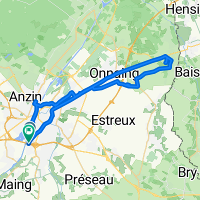
scandinavian tour
A cycling route starting in La Sentinelle, Hauts-de-France, France.
Overview
About this route
discovering the scandinavian countries
- -:--
- Duration
- 5,986.7 km
- Distance
- 2,690 m
- Ascent
- 2,693 m
- Descent
- ---
- Avg. speed
- ---
- Max. altitude
Continue with Bikemap
Use, edit, or download this cycling route
You would like to ride scandinavian tour or customize it for your own trip? Here is what you can do with this Bikemap route:
Free features
- Save this route as favorite or in collections
- Copy & plan your own version of this route
- Split it into stages to create a multi-day tour
- Sync your route with Garmin or Wahoo
Premium features
Free trial for 3 days, or one-time payment. More about Bikemap Premium.
- Navigate this route on iOS & Android
- Export a GPX / KML file of this route
- Create your custom printout (try it for free)
- Download this route for offline navigation
Discover more Premium features.
Get Bikemap PremiumFrom our community
Other popular routes starting in La Sentinelle
- Gilles Polomé Aviation
- Distance
- 6.9 km
- Ascent
- 17 m
- Descent
- 14 m
- Location
- La Sentinelle, Hauts-de-France, France
- De Rue Malplaquet 12, Valenciennes à Rue du Moulin 9, Villers-Pol
- Distance
- 17.8 km
- Ascent
- 94 m
- Descent
- 45 m
- Location
- La Sentinelle, Hauts-de-France, France
- 24-04-2022
- Distance
- 18.8 km
- Ascent
- 225 m
- Descent
- 229 m
- Location
- La Sentinelle, Hauts-de-France, France
- 20 km alentour Valenciennes
- Distance
- 20.8 km
- Ascent
- 141 m
- Descent
- 146 m
- Location
- La Sentinelle, Hauts-de-France, France
- Tour de France V2 E7: Valenciennes - Rethel
- Distance
- 181.6 km
- Ascent
- 594 m
- Descent
- 540 m
- Location
- La Sentinelle, Hauts-de-France, France
- Tour Trith 20 km
- Distance
- 18.7 km
- Ascent
- 149 m
- Descent
- 148 m
- Location
- La Sentinelle, Hauts-de-France, France
- 92 ter Rue du Vert Gazon, Valenciennes à 212 Avenue Anatole France, Anzin
- Distance
- 5.6 km
- Ascent
- 38 m
- Descent
- 13 m
- Location
- La Sentinelle, Hauts-de-France, France
- scandinavian tour
- Distance
- 5,986.7 km
- Ascent
- 2,690 m
- Descent
- 2,693 m
- Location
- La Sentinelle, Hauts-de-France, France
Open it in the app