

浜北-秋葉山(秋葉神社)
A cycling route starting in Hamakita, Shizuoka, Japan.
Overview
About this route
- -:--
- Duration
- 67.9 km
- Distance
- 970 m
- Ascent
- 967 m
- Descent
- ---
- Avg. speed
- ---
- Max. altitude

Route quality
Waytypes & surfaces along the route
Waytypes
Quiet road
27.2 km
(40 %)
Cycleway
27.2 km
(40 %)
Surfaces
Paved
33.9 km
(50 %)
Paved (undefined)
26.5 km
(39 %)
Asphalt
7.5 km
(11 %)
Undefined
33.9 km
(50 %)
Continue with Bikemap
Use, edit, or download this cycling route
You would like to ride 浜北-秋葉山(秋葉神社) or customize it for your own trip? Here is what you can do with this Bikemap route:
Free features
- Save this route as favorite or in collections
- Copy & plan your own version of this route
- Sync your route with Garmin or Wahoo
Premium features
Free trial for 3 days, or one-time payment. More about Bikemap Premium.
- Navigate this route on iOS & Android
- Export a GPX / KML file of this route
- Create your custom printout (try it for free)
- Download this route for offline navigation
Discover more Premium features.
Get Bikemap PremiumFrom our community
Other popular routes starting in Hamakita
 浜北-福田漁港
- Distance
- 68.3 km
- Ascent
- 79 m
- Descent
- 79 m
- Location
- Hamakita, Shizuoka, Japan
 浜北-浜北森林公園
- Distance
- 17.7 km
- Ascent
- 178 m
- Descent
- 175 m
- Location
- Hamakita, Shizuoka, Japan
 浜北-秋葉神社下社-アクティ森
- Distance
- 65.8 km
- Ascent
- 517 m
- Descent
- 515 m
- Location
- Hamakita, Shizuoka, Japan
 浜北-豊岡(20km)
- Distance
- 19.9 km
- Ascent
- 110 m
- Descent
- 109 m
- Location
- Hamakita, Shizuoka, Japan
 浜北-油山寺、可睡斎、法多山
- Distance
- 55.6 km
- Ascent
- 340 m
- Descent
- 341 m
- Location
- Hamakita, Shizuoka, Japan
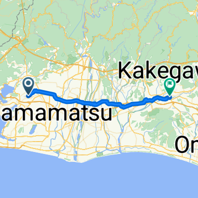 桜台4丁目, 浜松市へ掛川, 掛川市
- Distance
- 37.2 km
- Ascent
- 174 m
- Descent
- 189 m
- Location
- Hamakita, Shizuoka, Japan
 浜北-天竜川河口
- Distance
- 49.5 km
- Ascent
- 133 m
- Descent
- 130 m
- Location
- Hamakita, Shizuoka, Japan
 浜北-桜咲く学校
- Distance
- 60.1 km
- Ascent
- 482 m
- Descent
- 480 m
- Location
- Hamakita, Shizuoka, Japan
Open it in the app