

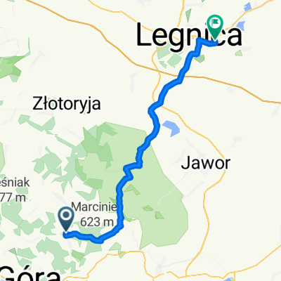
1995.07.23 Mysłów - Jelenia Góra - Strzegom - Wrocław
A cycling route starting in Wojcieszów, Lower Silesian Voivodeship, Poland.
Overview
About this route
I completed this trip on July 23, 1995.
- -:--
- Duration
- 140.5 km
- Distance
- 375 m
- Ascent
- 717 m
- Descent
- ---
- Avg. speed
- ---
- Max. altitude

Route quality
Waytypes & surfaces along the route
Waytypes
Quiet road
21.1 km
(15 %)
Road
19.7 km
(14 %)
Surfaces
Paved
103.9 km
(74 %)
Unpaved
5.6 km
(4 %)
Asphalt
103.9 km
(74 %)
Ground
4.2 km
(3 %)
Continue with Bikemap
Use, edit, or download this cycling route
You would like to ride 1995.07.23 Mysłów - Jelenia Góra - Strzegom - Wrocław or customize it for your own trip? Here is what you can do with this Bikemap route:
Free features
- Save this route as favorite or in collections
- Copy & plan your own version of this route
- Split it into stages to create a multi-day tour
- Sync your route with Garmin or Wahoo
Premium features
Free trial for 3 days, or one-time payment. More about Bikemap Premium.
- Navigate this route on iOS & Android
- Export a GPX / KML file of this route
- Create your custom printout (try it for free)
- Download this route for offline navigation
Discover more Premium features.
Get Bikemap PremiumFrom our community
Other popular routes starting in Wojcieszów
 Dłużek
- Distance
- 14.9 km
- Ascent
- 329 m
- Descent
- 329 m
- Location
- Wojcieszów, Lower Silesian Voivodeship, Poland
 Road Bike Dobków, till Wrocław
- Distance
- 102.6 km
- Ascent
- 402 m
- Descent
- 622 m
- Location
- Wojcieszów, Lower Silesian Voivodeship, Poland
 Wojcieszow_Swierzawa_NowyKosciol_Wj
- Distance
- 50 km
- Ascent
- 611 m
- Descent
- 586 m
- Location
- Wojcieszów, Lower Silesian Voivodeship, Poland
 Snabba versionen Dobków till Wrocław
- Distance
- 88.6 km
- Ascent
- 351 m
- Descent
- 570 m
- Location
- Wojcieszów, Lower Silesian Voivodeship, Poland
 Zima 2020. Wokół Kaczorowa.
- Distance
- 20.7 km
- Ascent
- 606 m
- Descent
- 605 m
- Location
- Wojcieszów, Lower Silesian Voivodeship, Poland
 niedziela
- Distance
- 56 km
- Ascent
- 586 m
- Descent
- 701 m
- Location
- Wojcieszów, Lower Silesian Voivodeship, Poland
 EDK_legnica_2017
- Distance
- 46.1 km
- Ascent
- 477 m
- Descent
- 691 m
- Location
- Wojcieszów, Lower Silesian Voivodeship, Poland
 EDK ws.2.0
- Distance
- 46.1 km
- Ascent
- 467 m
- Descent
- 681 m
- Location
- Wojcieszów, Lower Silesian Voivodeship, Poland
Open it in the app