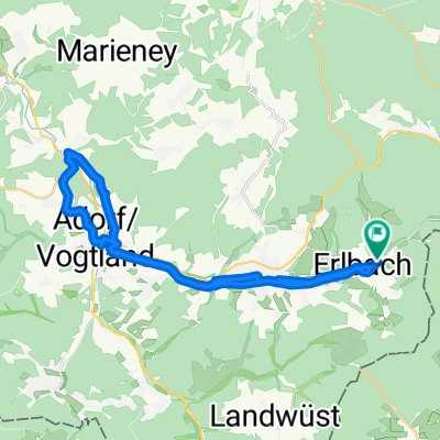
Lasselino
- 47 km
- 730 m
- 726 m
- Erlbach, Saxony, Germany
The route runs along the border path towards the Czech Republic up to the Hohen Stein (viewing platform). The border trail itself is very narrow, very rooted, with some steep climbs and fast descents, in short, nothing for beginners (helmet mandatory!). Suitable for freeride & downhill, only limited for CC riders. After enjoying the view from Hohenstein in the form of a short climbing break, the journey continues toward Waldschenke Eubabrunn, where you can sample Vogtland cuisine. To conclude, a final gentle ascent over the Schulteiche, followed by a last quick descent along the forest with views of some pastures before you rattle back towards the starting point on a gravel path. Of course, the tour can be extended as desired (e.g., towards Wernitzgrün, etc.). With breaks at the described places, the tour can be extended to 3-4 hours.
If you have questions or carpooling opportunities, just fire up ICQ and drop me a message (132360042).
Free trial for 3 days, or one-time payment. More about Bikemap Premium.
Discover more Premium features.
Get Bikemap PremiumOpen it in the app