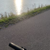
Cesta 583, Nededza až Nezbudská Lúčka
- 20.1 km
- 1,002 m
- 320 m
- Krasňany, Žilina Region, Slovakia
A cycling route starting in Krasňany, Žilina Region, Slovakia.
Overview
Cca 28km - 2-3h
Allterrain 80%road (cesta)
10%forrest (les)
5%meadow (lúka)
4%gravel (štrk)
1%mud (blatko)
Difficulty - easy/medium
Kruty popis sa mi podaril :D
Tak veľa šťastia!
Have a pleasant tour!
;)
Route quality
Quiet road
7.2 km
26 %
Cycleway
7 km
25 %
Paved
15 km
(54 %)
Unpaved
5.3 km
(19 %)
Asphalt
15 km
54 %
Ground
3.1 km
11 %
Route highlights
Icecream - zmrzlina :)
Stránik hill - 769m osl. altitude (mnm)
PUB - hospodka
PUB - Obcerstvenie
Rínok square - námestie
Vodné dielo Žilina - Water powerplant
Pizza
Continue with Bikemap
You would like to ride Varín-Gbeľany-Nededza-K.Lúčka-Zástranie-Teplička n/Váhom-Varín or customize it for your own trip? Here is what you can do with this Bikemap route:
Free trial for 3 days, or one-time payment. More about Bikemap Premium.
Discover more Premium features.
Get Bikemap PremiumFrom our community
Open it in the app