

COL DE PANTHALEON (por Châtillon)
A cycling route starting in Châtillon, Aosta Valley, Italy.
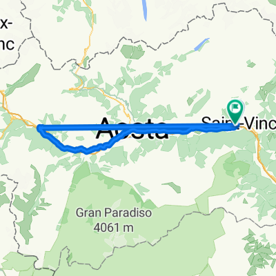
Overview
About this route
- -:--
- Duration
- 17.5 km
- Distance
- 1,140 m
- Ascent
- 8 m
- Descent
- ---
- Avg. speed
- ---
- Max. altitude

Route quality
Waytypes & surfaces along the route
Waytypes
Road
9.8 km
(56 %)
Quiet road
0.4 km
(2 %)
Surfaces
Paved
4.9 km
(28 %)
Asphalt
4.9 km
(28 %)
Undefined
12.6 km
(72 %)
Continue with Bikemap
Use, edit, or download this cycling route
You would like to ride COL DE PANTHALEON (por Châtillon) or customize it for your own trip? Here is what you can do with this Bikemap route:
Free features
- Save this route as favorite or in collections
- Copy & plan your own version of this route
- Sync your route with Garmin or Wahoo
Premium features
Free trial for 3 days, or one-time payment. More about Bikemap Premium.
- Navigate this route on iOS & Android
- Export a GPX / KML file of this route
- Create your custom printout (try it for free)
- Download this route for offline navigation
Discover more Premium features.
Get Bikemap PremiumFrom our community
Other popular routes starting in Châtillon
 Etape Giro 2018
- Distance
- 99.8 km
- Ascent
- 3,480 m
- Descent
- 1,993 m
- Location
- Châtillon, Aosta Valley, Italy
 Chatillon Grand-Moulin Alpe Parafromia Chatillon
- Distance
- 40.7 km
- Ascent
- 1,524 m
- Descent
- 1,525 m
- Location
- Châtillon, Aosta Valley, Italy
 Giro di Cervinia
- Distance
- 56.8 km
- Ascent
- 1,747 m
- Descent
- 1,744 m
- Location
- Châtillon, Aosta Valley, Italy
 Frankovska_D_13
- Distance
- 90.7 km
- Ascent
- 339 m
- Descent
- 644 m
- Location
- Châtillon, Aosta Valley, Italy
 Chatillon - La Salle
- Distance
- 92.5 km
- Ascent
- 2,772 m
- Descent
- 2,734 m
- Location
- Châtillon, Aosta Valley, Italy
 Col Saint Pantaleon e Cervinia
- Distance
- 78.7 km
- Ascent
- 2,486 m
- Descent
- 2,487 m
- Location
- Châtillon, Aosta Valley, Italy
 Chatilon-Cervinia
- Distance
- 27.8 km
- Ascent
- 1,495 m
- Descent
- 0 m
- Location
- Châtillon, Aosta Valley, Italy
 BREUIL-CERVINIA, por Châtillon
- Distance
- 26.4 km
- Ascent
- 1,459 m
- Descent
- 4 m
- Location
- Châtillon, Aosta Valley, Italy
Open it in the app