

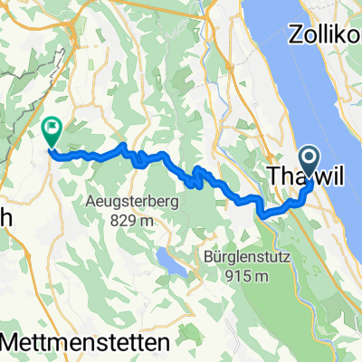
Thalwil - Albis - Sihlbrugg - Thalwil
A cycling route starting in Thalwil / See, Canton of Zurich, Switzerland.OverviewAbout this route
- -:--
- Duration
- 30.9 km
- Distance
- 589 m
- Ascent
- 586 m
- Descent
- ---
- Avg. speed
- ---
- Max. altitude
kindtomcreated this 15 years ago
Waytypes
Road
5.9 km19 %Path
1.9 km6 %
Surfaces
Paved
26.6 km(86 %)Asphalt
26.6 km86 %Undefined
4.3 km14 %
Free features
- Save this route as favorite or in collections
- Copy & plan your own version of this route
- Sync your route with Garmin or Wahoo
Premium features
Free trial for 3 days, or one-time payment. More about Bikemap Premium.
- Navigate this route on iOS & Android
- Export a GPX / KML file of this route
- Create your custom printout (try it for free)
- Download this route for offline navigation
Discover more Premium features.
Get Bikemap Premium- Thalwil - Hirzel - Thalwil
- 36.8 km
- 448 m
- 448 m
- Thalwil / See, Canton of Zurich, Switzerland
- Farbstrasse 1, Thalwil nach Ahornstrasse 21, Zürich
- 14.8 km
- 87 m
- 100 m
- Thalwil / See, Canton of Zurich, Switzerland
- Thalwil - Albis - Sihlbrugg - Thalwil
- 30.9 km
- 589 m
- 586 m
- Thalwil / See, Canton of Zurich, Switzerland
- Thalwil - Horgen - Oberrieden - Thalwil (Laufen)
- 10.1 km
- 164 m
- 109 m
- Thalwil / See, Canton of Zurich, Switzerland
- Thalwil - Rapperswil - Thalwil (Faehre)
- 52.7 km
- 117 m
- 95 m
- Thalwil / See, Canton of Zurich, Switzerland
- Seestrasse 88, Thalwil nach Zehntenhofweg 5, Thalwil
- 18.4 km
- 125 m
- 126 m
- Thalwil / See, Canton of Zurich, Switzerland
- Zehntenhofweg 7, Thalwil nach Seestrasse 2, Innerthal
- 51.9 km
- 1,383 m
- 918 m
- Thalwil / See, Canton of Zurich, Switzerland


Open it in the app