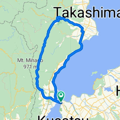
To Hata no Tanada (rice field terraces)
A cycling route starting in Kitahama, Shiga Prefecture, Japan.
Overview
About this route
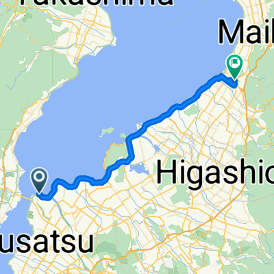
From J-Hoppers Lake Biwa to Hata no Tanada (rice field terraces). I couldn't draw the line after acrossing the bridge over Otomegaike pond. However, you can cycle to the other side and arrive to the road beside the railway. No need to go down.
- -:--
- Duration
- 22.8 km
- Distance
- 296 m
- Ascent
- 42 m
- Descent
- ---
- Avg. speed
- ---
- Avg. speed
Route quality
Waytypes & surfaces along the route
Waytypes
Busy road
7.2 km
(32 %)
Quiet road
4.4 km
(20 %)
Surfaces
Paved
4 km
(18 %)
Asphalt
2.5 km
(11 %)
Paved (undefined)
1.6 km
(7 %)
Undefined
18.7 km
(82 %)
Route highlights
Points of interest along the route
Photo after 8.3 km
Shirahige-jinja Shrine
Photo after 10.3 km
Otomegaike Pond
Continue with Bikemap
Use, edit, or download this cycling route
You would like to ride To Hata no Tanada (rice field terraces) or customize it for your own trip? Here is what you can do with this Bikemap route:
Free features
- Save this route as favorite or in collections
- Copy & plan your own version of this route
- Sync your route with Garmin or Wahoo
Premium features
Free trial for 3 days, or one-time payment. More about Bikemap Premium.
- Navigate this route on iOS & Android
- Export a GPX / KML file of this route
- Create your custom printout (try it for free)
- Download this route for offline navigation
Discover more Premium features.
Get Bikemap PremiumFrom our community
Other popular routes starting in Kitahama
- From hostel to Shirahige Shrine
- Distance
- 8 km
- Ascent
- 21 m
- Descent
- 20 m
- Location
- Kitahama, Shiga Prefecture, Japan
- 水保町1369-1, 守山市 to 江頭町627-9, 近江八幡市
- Distance
- 15.5 km
- Ascent
- 119 m
- Descent
- 120 m
- Location
- Kitahama, Shiga Prefecture, Japan
- 志賀駅, 大津市 to 志賀駅, 大津市
- Distance
- 148.3 km
- Ascent
- 131 m
- Descent
- 168 m
- Location
- Kitahama, Shiga Prefecture, Japan
- 道路, 守山市 to 2丁目 18, 大津市
- Distance
- 114.9 km
- Ascent
- 39 m
- Descent
- 59 m
- Location
- Kitahama, Shiga Prefecture, Japan
- 守山~瀬田・信楽・草津ルート
- Distance
- 92.1 km
- Ascent
- 1,081 m
- Descent
- 1,078 m
- Location
- Kitahama, Shiga Prefecture, Japan
- 今浜町, 守山市 to 新浜町440-1, 草津市
- Distance
- 170.5 km
- Ascent
- 924 m
- Descent
- 921 m
- Location
- Kitahama, Shiga Prefecture, Japan
- 2876-1, Imahamacho, Moriyama-Shi to Sazanami-kaido Street, Moriyama-Shi
- Distance
- 70 km
- Ascent
- 648 m
- Descent
- 648 m
- Location
- Kitahama, Shiga Prefecture, Japan
- 白鬚神舍,宇治橋,平等院,京都車站。
- Distance
- 68.6 km
- Ascent
- 236 m
- Descent
- 295 m
- Location
- Kitahama, Shiga Prefecture, Japan
Open it in the app