

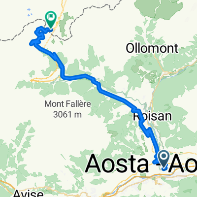
ALTO DEL LAGO DI PLACE-MOULIN (por Bionaz)
A cycling route starting in Aosta, Aosta Valley, Italy.
Overview
About this route
- -:--
- Duration
- 31.9 km
- Distance
- 1,493 m
- Ascent
- 92 m
- Descent
- ---
- Avg. speed
- ---
- Avg. speed

Route quality
Waytypes & surfaces along the route
Waytypes
Busy road
19.3 km
(61 %)
Road
6.5 km
(20 %)
Surfaces
Paved
21.2 km
(66 %)
Unpaved
2.4 km
(8 %)
Asphalt
21.2 km
(66 %)
Ground
2.4 km
(8 %)
Undefined
8.3 km
(26 %)
Continue with Bikemap
Use, edit, or download this cycling route
You would like to ride ALTO DEL LAGO DI PLACE-MOULIN (por Bionaz) or customize it for your own trip? Here is what you can do with this Bikemap route:
Free features
- Save this route as favorite or in collections
- Copy & plan your own version of this route
- Sync your route with Garmin or Wahoo
Premium features
Free trial for 3 days, or one-time payment. More about Bikemap Premium.
- Navigate this route on iOS & Android
- Export a GPX / KML file of this route
- Create your custom printout (try it for free)
- Download this route for offline navigation
Discover more Premium features.
Get Bikemap PremiumFrom our community
Other popular routes starting in Aosta
 F52 aosta to nus
- Distance
- 14.3 km
- Ascent
- 48 m
- Descent
- 85 m
- Location
- Aosta, Aosta Valley, Italy
 AOSTA 02 Gran SB + Verrogne
- Distance
- 98.7 km
- Ascent
- 3,045 m
- Descent
- 3,047 m
- Location
- Aosta, Aosta Valley, Italy
 Aosta - Aosta Day 1
- Distance
- 140.8 km
- Ascent
- 3,178 m
- Descent
- 3,187 m
- Location
- Aosta, Aosta Valley, Italy
 2-Tag_Aosta-ValD-isere
- Distance
- 94.3 km
- Ascent
- 2,400 m
- Descent
- 1,177 m
- Location
- Aosta, Aosta Valley, Italy
 Col du Gd-St Bernard
- Distance
- 36.9 km
- Ascent
- 1,917 m
- Descent
- 23 m
- Location
- Aosta, Aosta Valley, Italy
 Alps 1991 18.8. Tag4b
- Distance
- 79.5 km
- Ascent
- 1,881 m
- Descent
- 1,973 m
- Location
- Aosta, Aosta Valley, Italy
 Francja: nie Pinerolo, a Aosta - reverse
- Distance
- 618.6 km
- Ascent
- 7,251 m
- Descent
- 7,252 m
- Location
- Aosta, Aosta Valley, Italy
 Alpencross 2007/2 - Aosta bis GranParadiso
- Distance
- 43.2 km
- Ascent
- 2,071 m
- Descent
- 48 m
- Location
- Aosta, Aosta Valley, Italy
Open it in the app