C38.5 WPC
- 62.3 km
- 355 m
- 357 m
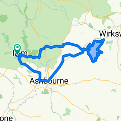
- Ashbourne, England, United Kingdom
A cycling route starting in Ashbourne, England, United Kingdom.
Overview
created this 6 years ago
Route quality
Quiet road
48.1 km
(62 %)
Road
25.6 km
(33 %)
Paved
16.3 km
(21 %)
Unpaved
0.8 km
(1 %)
Asphalt
16.3 km
(21 %)
Unpaved (undefined)
0.8 km
(1 %)
Undefined
60.5 km
(78 %)
Continue with Bikemap
You would like to ride Flashy Manifold Trail or customize it for your own trip? Here is what you can do with this Bikemap route:
Free trial for 3 days, or one-time payment. More about Bikemap Premium.
Discover more Premium features.
Get Bikemap PremiumFrom our community
Open it in the app