

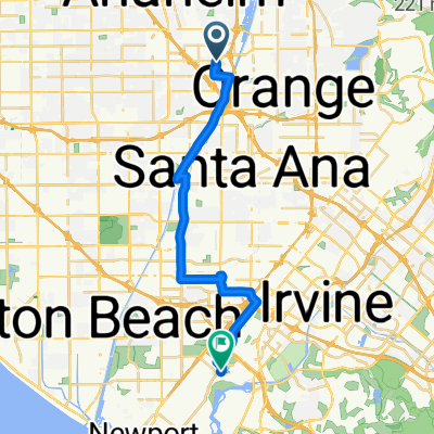
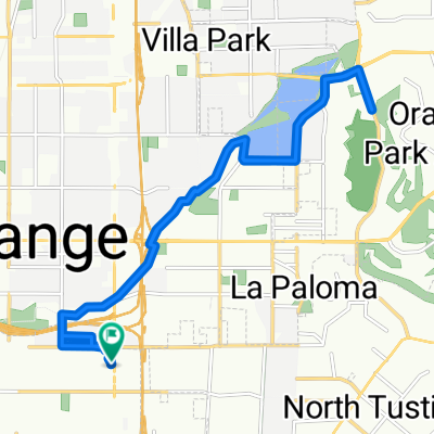
Orange Cycling
A cycling route starting in Orange, California, United States.
Overview
About this route
Edge510®
- -:--
- Duration
- 41.2 km
- Distance
- 135 m
- Ascent
- 136 m
- Descent
- ---
- Avg. speed
- ---
- Max. altitude
Route quality
Waytypes & surfaces along the route
Waytypes
Cycleway
39.6 km
(96 %)
Quiet road
0.8 km
(2 %)
Surfaces
Paved
23.5 km
(57 %)
Asphalt
15.7 km
(38 %)
Paved (undefined)
7.8 km
(19 %)
Undefined
17.7 km
(43 %)
Continue with Bikemap
Use, edit, or download this cycling route
You would like to ride Orange Cycling or customize it for your own trip? Here is what you can do with this Bikemap route:
Free features
- Save this route as favorite or in collections
- Copy & plan your own version of this route
- Sync your route with Garmin or Wahoo
Premium features
Free trial for 3 days, or one-time payment. More about Bikemap Premium.
- Navigate this route on iOS & Android
- Export a GPX / KML file of this route
- Create your custom printout (try it for free)
- Download this route for offline navigation
Discover more Premium features.
Get Bikemap PremiumFrom our community
Other popular routes starting in Orange

Edge510®
Orange Cycling- Distance
- 41.2 km
- Ascent
- 135 m
- Descent
- 136 m
- Location
- Orange, California, United States
 Ball Road to Yorba Linda Regional Park
- Distance
- 13.2 km
- Ascent
- 63 m
- Descent
- 27 m
- Location
- Orange, California, United States
 ride from Anaheim to Newport Beach
- Distance
- 25.1 km
- Ascent
- 19 m
- Descent
- 46 m
- Location
- Orange, California, United States
 North Tustin Avenue 2480, Santa Ana to North Tustin Avenue 2480, Santa Ana
- Distance
- 19.2 km
- Ascent
- 122 m
- Descent
- 127 m
- Location
- Orange, California, United States
 OC Brewery Ride (Transit/Santa Ana River Trl)
- Distance
- 18.5 km
- Ascent
- 20 m
- Descent
- 20 m
- Location
- Orange, California, United States
 Stt To Hb
- Distance
- 44.7 km
- Ascent
- 48 m
- Descent
- 47 m
- Location
- Orange, California, United States
 Recovered Route
- Distance
- 25.7 km
- Ascent
- 130 m
- Descent
- 50 m
- Location
- Orange, California, United States
 first time to the beach
- Distance
- 16.1 km
- Ascent
- 66 m
- Descent
- 93 m
- Location
- Orange, California, United States
Open it in the app