

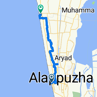
Relaxed route in champakulam
A cycling route starting in Alappuzha, Kerala, India.
Overview
About this route
- 2 h 56 min
- Duration
- 34 km
- Distance
- 48 m
- Ascent
- 82 m
- Descent
- 11.6 km/h
- Avg. speed
- ---
- Max. altitude

Route quality
Waytypes & surfaces along the route
Waytypes
Quiet road
6.8 km
(20 %)
Track
1 km
(3 %)
Surfaces
Paved
19.1 km
(56 %)
Unpaved
1 km
(3 %)
Asphalt
19.1 km
(56 %)
Unpaved (undefined)
1 km
(3 %)
Undefined
14 km
(41 %)
Continue with Bikemap
Use, edit, or download this cycling route
You would like to ride Relaxed route in champakulam or customize it for your own trip? Here is what you can do with this Bikemap route:
Free features
- Save this route as favorite or in collections
- Copy & plan your own version of this route
- Sync your route with Garmin or Wahoo
Premium features
Free trial for 3 days, or one-time payment. More about Bikemap Premium.
- Navigate this route on iOS & Android
- Export a GPX / KML file of this route
- Create your custom printout (try it for free)
- Download this route for offline navigation
Discover more Premium features.
Get Bikemap PremiumFrom our community
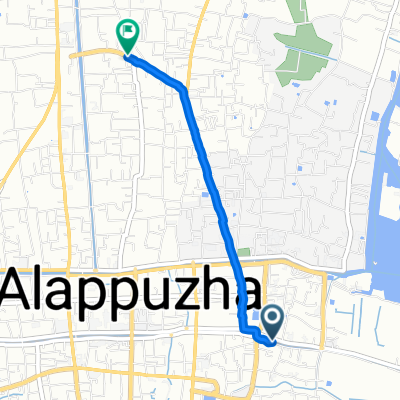
Other popular routes starting in Alappuzha
 Alappuzha to Kuttanad
- Distance
- 30.5 km
- Ascent
- 35 m
- Descent
- 42 m
- Location
- Alappuzha, Kerala, India
 Alappuzha to Cherthala
- Distance
- 17.9 km
- Ascent
- 34 m
- Descent
- 26 m
- Location
- Alappuzha, Kerala, India
 43/1403, Alappuzha to Civil Lane Colony, Kochi
- Distance
- 66.3 km
- Ascent
- 421 m
- Descent
- 411 m
- Location
- Alappuzha, Kerala, India
 43/1403, Alappuzha to Kozhikode - Palakkad Highway 17
- Distance
- 240.5 km
- Ascent
- 897 m
- Descent
- 890 m
- Location
- Alappuzha, Kerala, India
 43/1403, Alappuzha to Pullikkanam - Elappara Road, Vagamon
- Distance
- 104.2 km
- Ascent
- 2,391 m
- Descent
- 1,396 m
- Location
- Alappuzha, Kerala, India
 Alappuzha - Munroe Island
- Distance
- 85.5 km
- Ascent
- 218 m
- Descent
- 222 m
- Location
- Alappuzha, Kerala, India
 Route to The Vembanad Lake
- Distance
- 46.7 km
- Ascent
- 50 m
- Descent
- 49 m
- Location
- Alappuzha, Kerala, India
 Chungam Road, Alappuzha to Kommadi Palam Road 61, Aryad South
- Distance
- 3.1 km
- Ascent
- 23 m
- Descent
- 26 m
- Location
- Alappuzha, Kerala, India
Open it in the app